|
search place name
|
||
Les Deux Ponts (Algeria)Les Deux Ponts is a town in Algeria. An overview map of the region around Les Deux Ponts is displayed below.
regional and 3d topo map of Les Deux Ponts, Algeria ::

Les Deux Ponts airports ::
The nearest airport is CZL - Constantine Mohamed Boudiaf Intl, located 34.2 km south of Les Deux Ponts.
Other airports nearby include GJL - Jijel (73.3 km west), AAE - Annaba (106.9 km east), BJA - Bejaja Soummam (142.0 km west), TEE - Tebessa Cheikh Larbi Tebessi (184.1 km south east), Nearby towns ::
Mechtat Sfardjela (1.2km north west) //
Tarkount Sidi Ennouar (1.5km east) //
Mechtat er Rgarg (2.4km south east) //
Mechtat el Hiout (3.2km south east) //
Bou Saa (4.9km north) //
Mechtat el Djazia (4.3km south east) //
Mechtat Aïn Djenane (4.7km south west) //
Touhame (5.6km north east) //
Bou Trerou (4.9km east) //
Mechtat es Serdouk (5.6km south west) //
Mechtat Ben Ftaïma (6.9km south) //
Mechtat Barbaïga (7.3km south) //
Mechtat Sidi el Arbi (6.8km south east) //
Bourouhou (7.0km east) //
Zighout Youcef (7.9km south east) //
Ouled el Arbi (8.4km south west) //
[all distances 'as the bird flies' and approximate] 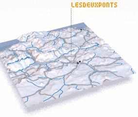 Places with similar names to Les Deux Ponts, Algeria :: Disclaimer :: Information on this page comes without warranty of any kind |
||
|
Where is Les Deux Ponts? Elevation and coordinates ::
Latitude (lat): 36°35'0"N Longitude (lon): 6°39'0"E
Elevation (approx.): 712m (map arrows pan, magnifying glasses zoom) |
||
|
Visiting Les Deux Ponts? Hotel/Accommodation ::
Book a hotel in Les Deux Ponts Travel Guide ::
Buy a travel guide for Algeria rental cars ::
car rental offers GPS waypoint ::
download a GPX waypoint (PoI) of Les Deux Ponts for your GPS receiver
|
||