|
search place name
|
||
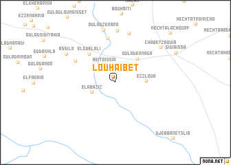
Louhaïbet (MʼSila, Algeria)Louhaïbet is a town in the MʼSila region of Algeria. An overview map of the region around Louhaïbet is displayed below.
regional and 3d topo map of Louhaïbet, Algeria ::
Louhaïbet airports ::
The nearest airport is ALG - Algier Houari Boumediene, located 102.5 km north west of Louhaïbet.
Other airports nearby include BJA - Bejaja Soummam (157.2 km north east), Nearby towns ::
Beït Aïssia (3.2km north west) //
El Abaziz (3.5km south west) //
Ez Zloua (4.0km east) //
Oulad en Naga (4.8km north east) //
El Guelali (5.8km north west) //
Ahmed Abd el Kader (7.2km north) //
Oulad Nehar (6.3km north west) //
Bou Setta (8.1km north) //
Bel Arba (8.4km north) //
Oulad Zerara (8.7km north) //
Assila (7.9km north west) //
Chabet Zaouïa (8.2km north east) //
[all distances 'as the bird flies' and approximate] 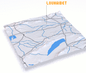 Places with similar names to Louhaïbet, Algeria ::
Disclaimer :: Information on this page comes without warranty of any kind |
||
|
Where is Louhaïbet? Elevation and coordinates ::
Latitude (lat): 35°50'53"N Longitude (lon): 3°40'58"E
Elevation (approx.): 648m (map arrows pan, magnifying glasses zoom) |
||
|
Visiting Louhaïbet? Hotel/Accommodation ::
Book a hotel in Louhaïbet Travel Guide ::
Buy a travel guide for Algeria rental cars ::
car rental offers GPS waypoint ::
download a GPX waypoint (PoI) of Louhaïbet for your GPS receiver
|
||