|
search place name
|
||
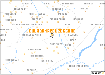
Oulad Amarou Zeggane (Algeria)Oulad Amarou Zeggane is a town in Algeria. An overview map of the region around Oulad Amarou Zeggane is displayed below.
regional and 3d topo map of Oulad Amarou Zeggane, Algeria ::
Oulad Amarou Zeggane airports ::
The nearest airport is BJA - Bejaja Soummam, located 58.9 km north east of Oulad Amarou Zeggane.
Other airports nearby include ALG - Algier Houari Boumediene (114.0 km west), GJL - Jijel (130.0 km east), BSK - Biskra (221.6 km south east), Nearby towns ::
Tasselent (3.5km south) //
Chellata (3.5km north east) //
Aït Sellam (4.0km south) //
Aït Aziz (3.5km north west) //
Tizi Mali (4.8km south) //
Tizit (4.7km north west) //
Beni Sellam (5.8km south) //
Taourirt Abar (5.8km north) //
Lamsella (5.8km north) //
Tifilkout (5.8km north west) //
El Ma (5.8km north east) //
Ighram (5.8km south east) //
Agoussim (6.3km north west) //
Feldene (6.0km east) //
Aït Aïssa Ou Yahia (6.0km west) //
Tifrit (6.2km east) //
Tarzoug (7.1km north west) //
Aït Ali Ou Mohannd (8.0km north) //
Ibeljiouene (7.3km south west) //
Amkrouz (8.0km north) //
Berkaïs (8.0km north) //
Aït Fdila (8.0km south) //
Tabouda (8.0km north) //
Egreb (8.0km north) //
Akbou (7.4km south east) //
Beni Ou ʼAmmar (8.2km south west) //
Taddart Gouadda (8.2km south west) //
Taharkatine (8.7km south west) //
Tizi Guefres (8.7km north west) //
[all distances 'as the bird flies' and approximate] 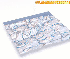 Places with similar names to Oulad Amarou Zeggane, Algeria :: Disclaimer :: Information on this page comes without warranty of any kind |
||
|
Where is Oulad Amarou Zeggane? Elevation and coordinates ::
Latitude (lat): 36°30'0"N Longitude (lon): 4°28'0"E
Elevation (approx.): 1093m (map arrows pan, magnifying glasses zoom) |
||
|
Visiting Oulad Amarou Zeggane? Hotel/Accommodation ::
Book a hotel in Oulad Amarou Zeggane Travel Guide ::
Buy a travel guide for Algeria rental cars ::
car rental offers GPS waypoint ::
download a GPX waypoint (PoI) of Oulad Amarou Zeggane for your GPS receiver
|
||