|
search place name
|
||
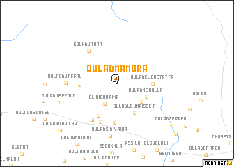
Oulad Mamora (Médéa, Algeria)Oulad Mamora is a town in the Médéa region of Algeria. An overview map of the region around Oulad Mamora is displayed below.
regional and 3d topo map of Oulad Mamora, Algeria ::
Oulad Mamora airports ::
The nearest airport is ALG - Algier Houari Boumediene, located 85.1 km north west of Oulad Mamora.
Other airports nearby include BJA - Bejaja Soummam (155.6 km north east), Nearby towns ::
El Khemarmia (3.6km south west) //
Oulad Mamora Mechta et Tenia (4.3km south east) //
Oulad Mekalla (4.4km south east) //
Oulad Loumaïsset (5.2km south east) //
Oulad el Guetatfa (4.6km east) //
Oulad Aïssa (4.8km west) //
Ez Zemamria (5.8km south west) //
Oulad Bou Chelba (6.4km south) //
El Ababdia (6.5km south) //
Souk Djamaa (6.3km north west) //
Oulad Rhenam (6.7km south west) //
Oulad Djaffal (6.6km west) //
Oulad Sidi Yahia (8.5km south) //
Oulad Zerara (9.7km south east) //
[all distances 'as the bird flies' and approximate] 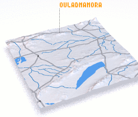 Places with similar names to Oulad Mamora, Algeria ::
Disclaimer :: Information on this page comes without warranty of any kind |
||
|
Where is Oulad Mamora? Elevation and coordinates ::
Latitude (lat): 35°59'7"N Longitude (lon): 3°35'13"E
Elevation (approx.): 846m (map arrows pan, magnifying glasses zoom) |
||
|
Visiting Oulad Mamora? Hotel/Accommodation ::
Book a hotel in Oulad Mamora Travel Guide ::
Buy a travel guide for Algeria rental cars ::
car rental offers GPS waypoint ::
download a GPX waypoint (PoI) of Oulad Mamora for your GPS receiver
|
||