|
search place name
|
||
Douar Ouled el Amraoui (Mostaganem, Algeria)Douar Ouled el Amraoui is a town in the Mostaganem region of Algeria. An overview map of the region around Douar Ouled el Amraoui is displayed below.
regional and 3d topo map of Douar Ouled el Amraoui, Algeria ::

Douar Ouled el Amraoui airports ::
The nearest airport is QAS - Ech-cheliff Ech Cheliff, located 80.6 km east of Douar Ouled el Amraoui.
Other airports nearby include MUW - Ghriss (106.0 km south), TAF - Oran Tafaraoui (109.6 km south west), ORN - Oran Es Senia (111.3 km south west), TID - Tiaret Bou Chekif (127.5 km south east), Nearby towns ::
Djillali Ben Larbi (2.3km north) //
Douar Sidi Lakhdar (2.1km north east) //
Douar Nʼaïmia (2.5km south) //
Douar Ouled Aïssa (2.8km east) //
Sidi Lakhdar (3.6km north) //
Douar Ouled Ghazi (2.9km east) //
Douar Farhia (3.4km north east) //
Sidi Ali (4.0km south west) //
Douar Ghraba (3.9km south east) //
Douar Ouled Bou Ziane (3.9km west) //
Douar Bachria (4.5km north west) //
Douar Ouachhia (4.0km north west) //
Douar Mʼsallaïne (4.8km north west) //
Douar Hammaïchia (5.0km north) //
Douar Chenanfa (4.2km east) //
Douar Hʼgagna (5.3km north) //
Douar Trebah Sahal (4.5km west) //
Douar Tekkour (4.4km east) //
Douar Zʼmaaïche (5.5km north) //
Douar Saïdia (5.8km north) //
Douar Khedaïdia (4.8km west) //
Douar Trebah Djebel (5.8km south) //
Douar Ouled Abdallah (5.1km north east) //
Douar Ouled Amara (5.4km north east) //
Douar el Koubania (5.9km south east) //
Douar Sidi Afif (5.8km south west) //
Saf Saf (6.5km south) //
Douar Tounine (5.3km east) //
Douar Kraïaia (6.5km south) //
[all distances 'as the bird flies' and approximate] 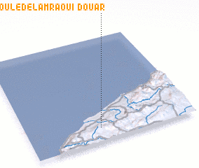 Places with similar names to Douar Ouled el Amraoui, Algeria :: Disclaimer :: Information on this page comes without warranty of any kind |
||
|
Where is Douar Ouled el Amraoui? Elevation and coordinates ::
Latitude (lat): 36°7'57"N Longitude (lon): 0°26'28"W
Elevation (approx.): 293m (map arrows pan, magnifying glasses zoom) |
||
|
Visiting Douar Ouled el Amraoui? Hotel/Accommodation ::
Book a hotel in Douar Ouled el Amraoui Travel Guide ::
Buy a travel guide for Algeria rental cars ::
car rental offers GPS waypoint ::
download a GPX waypoint (PoI) of Douar Ouled el Amraoui for your GPS receiver
|
||