|
search place name
|
||
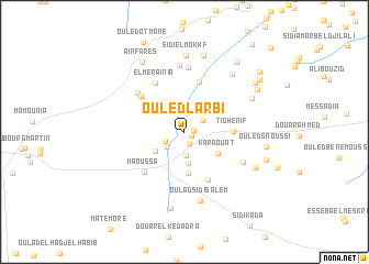
Ouled Larbi (Mascara, Algeria)Ouled Larbi is a town in the Mascara region of Algeria. An overview map of the region around Ouled Larbi is displayed below.
regional and 3d topo map of Ouled Larbi, Algeria ::
Ouled Larbi airports ::
The nearest airport is MUW - Ghriss, located 26.1 km south west of Ouled Larbi.
Other airports nearby include TAF - Oran Tafaraoui (75.3 km west), ORN - Oran Es Senia (85.2 km west), TID - Tiaret Bou Chekif (107.6 km east), QAS - Ech-cheliff Ech Cheliff (129.7 km north east), Nearby towns ::
Douar Ouled Adda (0.7km south east) //
Douar Ouled Mohammed (0.7km east) //
Douar Ouled Djilali (1.2km south) //
Douar Ouled Kadda (1.9km south west) //
Douar Krelaïlia (1.9km north east) //
Megaïdïa (2.1km south west) //
Ouled Missoum (2.4km south) //
Douar Sidi Abdallah (3.2km south) //
Ez Zaaïmia (3.2km south west) //
Douar el Araïssïa (3.5km north west) //
Karaouat (3.5km south east) //
Douar Oulad Sidi Ahmed Ben Ali (4.2km south) //
Sidi Mohammed Bene Zerga (4.0km north east) //
Tighenif (4.1km east) //
Dar Ben el Hassine (4.6km north west) //
Khalouia (5.2km north) //
Ouled Sidi Allah (5.2km south) //
Douar Ouled Sidi Mahi ed Dine (5.1km north west) //
El Meraïnia (5.5km north west) //
Maoussa (5.3km south west) //
Douar el Kefafia (5.6km north west) //
Sidi Barhdad (6.6km north) //
Douar Alalma (5.7km south east) //
Douar el Krelouïa (6.7km north) //
Oulad Sidi Salem (7.1km south) //
Douar es Smaïchïa (7.1km north east) //
Smaïchia (6.6km north east) //
Sidi el Mokhf (7.8km north) //
Douar ez Zaouïa (7.9km south) //
[all distances 'as the bird flies' and approximate] 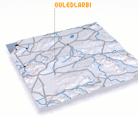 Places with similar names to Ouled Larbi, Algeria ::
// Oulad Larbi (MA)
// Oulad el Arbi (MA)
// Oulad al ʼArbi (MA)
// Oulad al ʼArbi (MA)
// Ouled el ʼArbi (DZ)
// Ouled El Arbi (DZ)
// Ouled el Arbi (DZ)
// Ouled el Arbi (DZ)
// Ouled el Arbi (DZ)
// Ouled el Arbi (DZ)
Disclaimer :: Information on this page comes without warranty of any kind |
||
|
Where is Ouled Larbi? Elevation and coordinates ::
Latitude (lat): 35°24'56"N Longitude (lon): 0°16'57"W
Elevation (approx.): 525m (map arrows pan, magnifying glasses zoom) |
||
|
Visiting Ouled Larbi? Hotel/Accommodation ::
Book a hotel in Ouled Larbi Travel Guide ::
Buy a travel guide for Algeria rental cars ::
car rental offers GPS waypoint ::
download a GPX waypoint (PoI) of Ouled Larbi for your GPS receiver
|
||