|
search place name
|
||
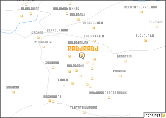
Radjradj (Médéa, Algeria)Radjradj is a town in the Médéa region of Algeria. An overview map of the region around Radjradj is displayed below.
regional and 3d topo map of Radjradj, Algeria ::
Radjradj airports ::
The nearest airport is ALG - Algier Houari Boumediene, located 70.6 km north of Radjradj.
Other airports nearby include QAS - Ech-cheliff Ech Cheliff (147.5 km west), TID - Tiaret Bou Chekif (159.1 km south west), Nearby towns ::
Zagmota (1.1km south east) //
Sidi Lakrdar (2.1km south east) //
Amar Ben Zaoui (2.1km east) //
Ouled Salah (2.8km north) //
Bellia (2.7km south east) //
Oulad Adim (2.8km south west) //
Oulad Touil (2.6km west) //
Cheraria (3.8km south) //
Chouenna (3.7km south west) //
Cheikr Taïeb (4.6km north east) //
Oulad Zeguia (4.8km south) //
Oulad Ben Adja (5.8km south) //
Derouat (5.8km south) //
Alama (6.4km south) //
Zoubiria (5.8km west) //
Tchacht (6.8km south west) //
Ben Alouach (7.4km north) //
Berrouaghia (7.1km north west) //
Rouania (7.8km south east) //
Mehadjbia (7.7km west) //
Hadj Aïssa Ben Zerrouk (10.0km south east) //
[all distances 'as the bird flies' and approximate] 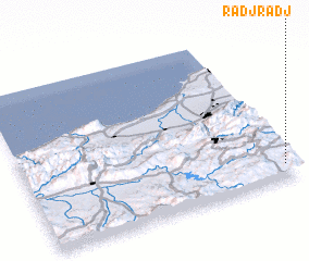 Places with similar names to Radjradj, Algeria :: Disclaimer :: Information on this page comes without warranty of any kind |
||
|
Where is Radjradj? Elevation and coordinates ::
Latitude (lat): 36°5'16"N Longitude (lon): 2°57'50"E
Elevation (approx.): 1023m (map arrows pan, magnifying glasses zoom) |
||
|
Visiting Radjradj? Hotel/Accommodation ::
Book a hotel in Radjradj Travel Guide ::
Buy a travel guide for Algeria rental cars ::
car rental offers GPS waypoint ::
download a GPX waypoint (PoI) of Radjradj for your GPS receiver
|
||