|
search place name
|
||
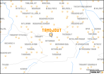
Tamdjout (Algeria)Tamdjout is a town in Algeria. An overview map of the region around Tamdjout is displayed below.
regional and 3d topo map of Tamdjout, Algeria ::
Tamdjout airports ::
The nearest airport is BJA - Bejaja Soummam, located 72.6 km east of Tamdjout.
Other airports nearby include ALG - Algier Houari Boumediene (96.8 km west), GJL - Jijel (144.7 km east), BSK - Biskra (235.2 km south east), Nearby towns ::
Agouni-n-Tsalent (1.5km east) //
Taourirt Menguellet (1.9km north) //
Tililit (2.4km north west) //
Aït Saada (2.6km south) //
Aït Hamsi (2.3km south east) //
ʼAïn el Hammam (3.2km north east) //
Aït el ʼAzîz (4.0km south) //
Aït Ali Ou Harzoun (3.5km south west) //
Azerou Kellat (4.6km north) //
Tassaft (3.8km west) //
Agouni Ouzemoun (4.8km north west) //
Beni Mahmoud (4.8km south east) //
Tazerout (4.5km east) //
Aguemoun Izem (5.8km north) //
Aït Mislaïn (5.8km south) //
Aït Mellal (4.8km north east) //
Bou Adenane (6.3km south west) //
Aït Hichem (5.8km north east) //
Icherridene (6.3km north west) //
Aït Abbas (6.0km west) //
Aït Meraou (7.5km north) //
Aït Bou Abd er Rahmane (6.2km west) //
Taourirt el Hadjadj (6.2km west) //
Tirourda (7.6km south) //
Tiguemounine (7.1km south west) //
Souk el Arba (7.0km south west) //
Aït Ziri (7.0km north east) //
Taka (8.1km north east) //
Taourirt Mimoun (7.5km west) //
[all distances 'as the bird flies' and approximate]  Places with similar names to Tamdjout, Algeria :: Disclaimer :: Information on this page comes without warranty of any kind |
||
|
Where is Tamdjout? Elevation and coordinates ::
Latitude (lat): 36°33'0"N Longitude (lon): 4°17'0"E
Elevation (approx.): 608m (map arrows pan, magnifying glasses zoom) |
||
|
Visiting Tamdjout? Hotel/Accommodation ::
Book a hotel in Tamdjout Travel Guide ::
Buy a travel guide for Algeria rental cars ::
car rental offers GPS waypoint ::
download a GPX waypoint (PoI) of Tamdjout for your GPS receiver
|
||