|
search place name
|
||
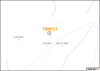
Tametit (Saïda, Algeria)Tametit is a town in the Saïda region of Algeria. An overview map of the region around Tametit is displayed below.
regional and 3d topo map of Tametit, Algeria ::
Tametit airports ::
The nearest airport is MUW - Ghriss, located 61.9 km north of Tametit.
Other airports nearby include TAF - Oran Tafaraoui (107.5 km north west), ORN - Oran Es Senia (119.2 km north west), TLM - Tlemcen Zenata (136.1 km west), TID - Tiaret Bou Chekif (154.9 km north east), Nearby towns ::
Ouazane (3.9km south) //
Moulay Larbi (5.3km south east) //
[all distances 'as the bird flies' and approximate] 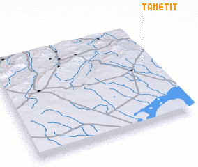 Places with similar names to Tametit, Algeria ::
// Dumatad (PH)
// Tomeidet (NO)
// Tumba-Ditu (CD)
// Dimtete (TP)
// Tametate (MX)
// Timetauta (PG)
// Tamadout (MA)
// Tamdit (MA)
// Tamdit (MA)
// Htimohtihta (MM)
Disclaimer :: Information on this page comes without warranty of any kind |
||
|
Where is Tametit? Elevation and coordinates ::
Latitude (lat): 34°40'4"N Longitude (lon): 0°1'25"W
Elevation (approx.): 1141m (map arrows pan, magnifying glasses zoom) |
||
|
Visiting Tametit? Hotel/Accommodation ::
Book a hotel in Tametit Travel Guide ::
Buy a travel guide for Algeria rental cars ::
car rental offers GPS waypoint ::
download a GPX waypoint (PoI) of Tametit for your GPS receiver
|
||