|
search place name
|
||
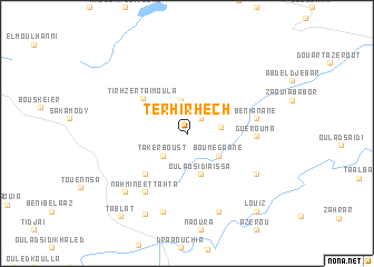
Terhirhech (Bouira, Algeria)Terhirhech is a town in the Bouira region of Algeria. An overview map of the region around Terhirhech is displayed below.
regional and 3d topo map of Terhirhech, Algeria ::
Terhirhech airports ::
The nearest airport is ALG - Algier Houari Boumediene, located 26.6 km north west of Terhirhech.
Other airports nearby include BJA - Bejaja Soummam (154.0 km east), TID - Tiaret Bou Chekif (214.1 km south west), Nearby towns ::
Oulad Allel (1.8km north east) //
Takerboust (2.9km south west) //
El Karrouch (2.7km east) //
Nahata (3.4km north) //
Bou Megrane (3.4km south east) //
Oulad Sidi Aïssa (4.2km south) //
Tirhzert Aïmoula (4.8km north west) //
Nahmine Tahta (5.3km south west) //
Guerouma (5.5km east) //
Beni Anâne (5.7km east) //
Nahmine et Tahta (6.9km south west) //
Zouaoudja (6.9km south east) //
Dechra Bouar (8.0km south) //
Dechret ech Chaab (8.2km south) //
Smar el Kedim (7.7km south west) //
Mouchene (8.7km south west) //
Louiz (9.5km south east) //
Tablat (9.8km south west) //
[all distances 'as the bird flies' and approximate] 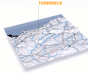 Places with similar names to Terhirhech, Algeria :: Disclaimer :: Information on this page comes without warranty of any kind |
||
|
Where is Terhirhech? Elevation and coordinates ::
Latitude (lat): 36°29'12"N Longitude (lon): 3°22'18"E
Elevation (approx.): 719m (map arrows pan, magnifying glasses zoom) |
||
|
Visiting Terhirhech? Hotel/Accommodation ::
Book a hotel in Terhirhech Travel Guide ::
Buy a travel guide for Algeria rental cars ::
car rental offers GPS waypoint ::
download a GPX waypoint (PoI) of Terhirhech for your GPS receiver
|
||