|
search place name
|
||
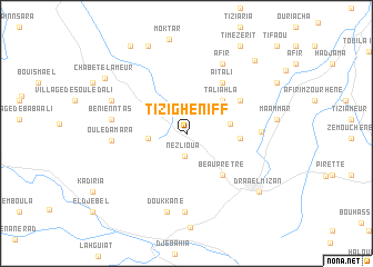
Tizi Gheniff (Tizi Ouzou, Algeria)Tizi Gheniff is a town in the Tizi Ouzou region of Algeria. An overview map of the region around Tizi Gheniff is displayed below.
regional and 3d topo map of Tizi Gheniff, Algeria ::
Tizi Gheniff airports ::
The nearest airport is ALG - Algier Houari Boumediene, located 50.7 km west of Tizi Gheniff.
Other airports nearby include BJA - Bejaja Soummam (117.3 km east), BSK - Biskra (267.3 km south east), Nearby towns ::
Nezlioua (2.3km south) //
Village Ben Tezerhrit (3.1km west) //
Irahalene (3.7km east) //
Taliahla (4.3km north east) //
Irhil Ou Ziane (4.4km east) //
Beauprêtre (5.1km south east) //
Aït Ali (5.9km north east) //
Taka (5.4km north east) //
Ichoukhene (6.0km east) //
Ouled Amara (6.1km west) //
Beni Enntas (6.2km west) //
Afir (7.5km north) //
Dechra Djouara (7.9km south) //
Doukkane (8.0km south) //
Ouled Sidi Saad (6.9km north west) //
Draa el Mizan (8.3km south east) //
Ouled Abd Allah (9.3km north) //
Chabet el Ameur (8.6km north west) //
El Azib el Madjene (9.2km north east) //
Timezerit (9.8km north east) //
Ichaoutene (9.9km north west) //
[all distances 'as the bird flies' and approximate] 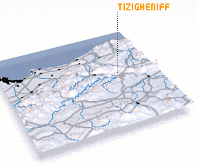 Places with similar names to Tizi Gheniff, Algeria :: Disclaimer :: Information on this page comes without warranty of any kind |
||
|
Where is Tizi Gheniff? Elevation and coordinates ::
Latitude (lat): 36°35'15"N Longitude (lon): 3°46'4"E
Elevation (approx.): 383m (map arrows pan, magnifying glasses zoom) |
||
|
Visiting Tizi Gheniff? Hotel/Accommodation ::
Book a hotel in Tizi Gheniff Travel Guide ::
Buy a travel guide for Algeria rental cars ::
car rental offers GPS waypoint ::
download a GPX waypoint (PoI) of Tizi Gheniff for your GPS receiver
|
||