|
search place name
|
||
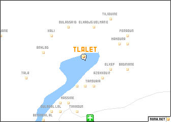
Tlalet (Algeria)Tlalet is a town in Algeria. An overview map of the region around Tlalet is displayed below.
regional and 3d topo map of Tlalet, Algeria ::
Tlalet airports ::
The nearest airport is TMX - Timimoun, located 12.5 km south of Tlalet.
Other airports nearby include AZR - Adrar Touat Cheikh Sidi Mohamed Belkebir (173.4 km south), Nearby towns ::
Azekkour (4.9km south east) //
Ouameni Sidi Saïd (5.6km south) //
Rhiaf (5.6km south) //
Tadlest (5.6km south) //
Tarouaïa (5.8km south) //
El Kef (5.2km east) //
Allamellal Sidi Cherif (5.8km south) //
El Hadj Guelmane (7.6km north) //
Mamoura (7.4km north east) //
Oumrad (7.4km north east) //
Oulad Saïd (8.1km north west) //
Kali (8.5km north west) //
[all distances 'as the bird flies' and approximate] 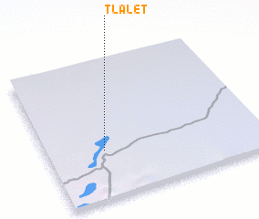 Places with similar names to Tlalet, Algeria ::
// Talilet (MA)
// Talilit (MA)
// Dulahlaut (ID)
// Tulaylāt (SY)
// Talilit (MA)
// Taouiloult (MA)
// Tililda (MA)
// Tloult (MA)
// Tall al ‘Aīdah (IQ)
// Talalt (MA)
Disclaimer :: Information on this page comes without warranty of any kind |
||
|
Where is Tlalet? Elevation and coordinates ::
Latitude (lat): 29°21'0"N Longitude (lon): 0°16'0"W
Elevation (approx.): 205m (map arrows pan, magnifying glasses zoom) |
||
|
Visiting Tlalet? Hotel/Accommodation ::
Book a hotel in Tlalet Travel Guide ::
Buy a travel guide for Algeria rental cars ::
car rental offers GPS waypoint ::
download a GPX waypoint (PoI) of Tlalet for your GPS receiver
|
||