|
search place name
|
||
Akhalsopʼeli (Kʼarelis Raioni, Georgia)Akhalsopʼeli is a town in the Kʼarelis Raioni region of Georgia. An overview map of the region around Akhalsopʼeli is displayed below.
regional and 3d topo map of Akhalsopʼeli, Georgia ::
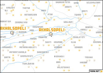
Nearby towns ::
Kudatke (2.5km south west) //
Dzhagaraantkari (3.3km south) //
Sukiti (3.3km south) //
Vedreba (3.8km south east) //
Okrosopeli (3.9km south west) //
Tatanaantubani (3.6km east) //
Kʼvenatkotsʼa (4.3km north east) //
Mokhisi (5.1km north) //
Khidiskuri (4.2km north west) //
Samtserisi (4.0km east) //
Agara (4.3km north east) //
Sanebeli (4.6km south east) //
Kintsvisi (5.4km south) //
Krobani (5.4km south) //
Imerliantkari (4.8km south west) //
Zghuderi (5.8km south) //
Zemo-Shakshaketi (6.1km north) //
Kvemo-Shakshaketi (6.3km north) //
Tsromi (5.2km west) //
Pʼtsʼa (7.0km north) //
Gomi (5.4km west) //
Kekhijvari (5.4km east) //
Berdzenauli (7.1km north) //
Nadarbazevi (5.9km south west) //
Shavsopeli (7.2km south) //
Doglauri (6.3km north east) //
Kobesaantubani (6.9km south east) //
Didi-Keleti (7.1km south west) //
Patara-Keleti (7.1km south west) //
[all distances 'as the bird flies' and approximate] 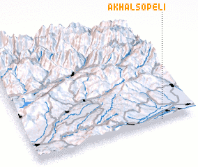 Places with similar names to Akhalsopʼeli, Georgia ::
// Akhalsopeli (GE)
// Akhalsop'eli (GE)
// Akhalsop'eli (GE)
// Akhalsop'eli (GE)
// Akhalsop'eli (GE)
// Akhalsopʼeli (GE)
// Akhalsopʼeli (GE)
// Akhalsopʼeli (GE)
// Akhalsopʼeli (GE)
// Akhalsopʼeli (GE)
Disclaimer :: Information on this page comes without warranty of any kind |
||
|
Where is Akhalsopʼeli? Elevation and coordinates ::
Latitude (lat): 42°0'44"N Longitude (lon): 43°47'34"E
Elevation (approx.): 647m (map arrows pan, magnifying glasses zoom) |
||
|
Visiting Akhalsopʼeli? Hotel/Accommodation ::
Book a hotel in Akhalsopʼeli Travel Guide ::
Buy a travel guide for Georgia rental cars ::
car rental offers GPS waypoint ::
download a GPX waypoint (PoI) of Akhalsopʼeli for your GPS receiver
|
||