|
search place name
|
||
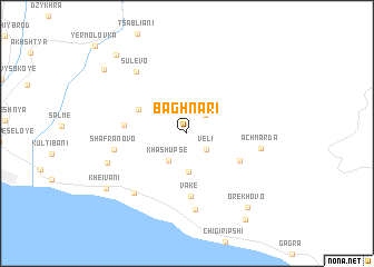
Baghnari (Abashis Raioni, Georgia)Baghnari is a town in the Abashis Raioni region of Georgia. An overview map of the region around Baghnari is displayed below.
regional and 3d topo map of Baghnari, Georgia ::
Baghnari airports ::
The nearest airport is AER - Sochi, located 15.7 km west of Baghnari.
Other airports nearby include KRR - Krasnodar Pashkovskiy (194.6 km north west), STW - Stavropol Shpakovskoye (243.6 km north east), Nearby towns ::
Veli (2.2km south east) //
Zegani (2.3km north east) //
Khashupʼse (3.1km south west) //
Imerkhevi (3.9km south) //
Mekhadiri (4.3km north west) //
Mendeleyevo (4.7km south east) //
Vake (6.3km south) //
Nakaduli (4.7km west) //
Shafranovo (5.6km west) //
Achʼmarda (5.6km east) //
Kholodnaia-Rechʼka (7.7km south) //
Sulevo (7.2km north west) //
Gantʼiadi (7.1km south west) //
Lkoti (6.5km south west) //
Orekhovo (8.7km south east) //
Kheivani (8.0km south west) //
Grebeshoki (9.7km south east) //
Salkhino (8.8km north west) //
Mikʼelripʼshi (9.4km north west) //
[all distances 'as the bird flies' and approximate] 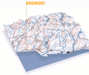 Places with similar names to Baghnari, Georgia ::
// Bāgh-e Anār (IR)
// Bāgh-e Anār (IR)
// Bāgh-e Anār (IR)
// Bāgh-e Anārī (IR)
// Bāgh-e Anārī (IR)
// Bāgh-e Nār (IR)
// Bāgh-e Nārī (IR)
Disclaimer :: Information on this page comes without warranty of any kind |
||
|
Where is Baghnari? Elevation and coordinates ::
Latitude (lat): 43°25'53"N Longitude (lon): 40°8'57"E
Elevation (approx.): 219m (map arrows pan, magnifying glasses zoom) |
||
|
Visiting Baghnari? Hotel/Accommodation ::
Book a hotel in Baghnari Travel Guide ::
Buy a travel guide for Georgia rental cars ::
car rental offers GPS waypoint ::
download a GPX waypoint (PoI) of Baghnari for your GPS receiver
|
||