|
search place name
|
||
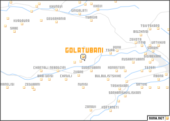
Golatubani (Abashis Raioni, Georgia)Golatubani is a town in the Abashis Raioni region of Georgia. An overview map of the region around Golatubani is displayed below.
regional and 3d topo map of Golatubani, Georgia ::
Nearby towns ::
Moliti (0.7km west) //
Bezhatubani (1.7km west) //
Gudatubani (2.6km south east) //
Zvare (3.5km south) //
Tsipʼa (4.5km east) //
Chrdili (5.2km south west) //
Nunisi (6.1km south) //
Nebodziri (5.0km south west) //
Bulbulistsikhe (5.7km south east) //
Monasteri (5.7km south east) //
Pona (5.7km east) //
Deisi (7.2km south west) //
Tsakva (8.8km north) //
Begleti (7.0km east) //
Tashiskari (8.6km south east) //
Gedsamania (9.7km north west) //
Sarmanishviliskari (10.3km south east) //
[all distances 'as the bird flies' and approximate] 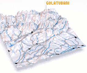 Places with similar names to Golatubani, Georgia ::
// Calituban (PH)
// Goldobino (RU)
// Koldobino (RU)
// Kaḩlī Ţayyibīn (SD)
// Kūledaban (PK)
// Calatabiano (IT)
// Kolʼtaban (KZ)
// Kolʼtaban (KZ)
// Kolʼtaban (KZ)
// Kolʼtaban (KZ)
Disclaimer :: Information on this page comes without warranty of any kind |
||
|
Where is Golatubani? Elevation and coordinates ::
Latitude (lat): 42°0'16"N Longitude (lon): 43°25'12"E
Elevation (approx.): 847m (map arrows pan, magnifying glasses zoom) |
||
|
Visiting Golatubani? Hotel/Accommodation ::
Book a hotel in Golatubani Travel Guide ::
Buy a travel guide for Georgia rental cars ::
car rental offers GPS waypoint ::
download a GPX waypoint (PoI) of Golatubani for your GPS receiver
|
||