|
search place name
|
||
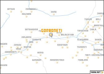
Gorboneti (Abashis Raioni, Georgia)Gorboneti is a town in the Abashis Raioni region of Georgia. An overview map of the region around Gorboneti is displayed below.
regional and 3d topo map of Gorboneti, Georgia ::
Gorboneti airports ::
The nearest airport is ERZ - Erzurum, located 202.2 km south of Gorboneti.
Nearby towns ::
Tsʼkhmorisi (1.7km south east) //
Abukʼetʼi (1.4km west) //
Akho (2.0km east) //
Kantauri (2.3km south west) //
Tsoniarisi (2.5km north west) //
Kokotauri (4.6km south east) //
Baladzeyebi (4.2km east) //
Kvashta (4.5km south west) //
Gegelidzeebi (4.5km south east) //
Dandalo (4.5km east) //
Kharaula (5.6km south east) //
Satskhovria (5.8km west) //
Merisi (7.2km south west) //
Silibauri (7.8km south) //
Vaio (6.3km south west) //
Khino (8.2km north) //
Ak'uts'a (8.0km south west) //
Inasharidzeebi (8.7km south west) //
Mopʼrinetʼi (9.3km south east) //
Samoletʼi (9.4km south east) //
[all distances 'as the bird flies' and approximate] 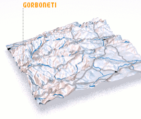 Places with similar names to Gorboneti, Georgia ::
Disclaimer :: Information on this page comes without warranty of any kind |
||
|
Where is Gorboneti? Elevation and coordinates ::
Latitude (lat): 41°39'0"N Longitude (lon): 42°3'0"E
Elevation (approx.): 483m (map arrows pan, magnifying glasses zoom) |
||
|
Visiting Gorboneti? Hotel/Accommodation ::
Book a hotel in Gorboneti Travel Guide ::
Buy a travel guide for Georgia rental cars ::
car rental offers GPS waypoint ::
download a GPX waypoint (PoI) of Gorboneti for your GPS receiver
|
||