|
search place name
|
||
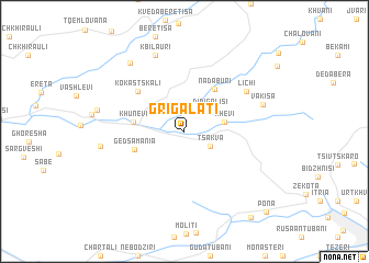
Grigalatʼi (Kharagaulis Raioni, Georgia)Grigalatʼi is a town in the Kharagaulis Raioni region of Georgia. An overview map of the region around Grigalatʼi is displayed below.
regional and 3d topo map of Grigalatʼi, Georgia ::
Nearby towns ::
Patara-Golisi (2.3km north east) //
Tsʼitsʼkiuri (2.6km north) //
Tsakva (2.5km south east) //
Didi-Golisi (2.9km north east) //
Khevi (3.2km east) //
Khunevi (3.9km west) //
Nadaburi (4.9km north east) //
Gedsamania (4.2km south west) //
Kokastskali (5.4km north west) //
Lichʼi (6.2km north east) //
Kbilauri (8.1km north) //
Vakisa (6.6km north east) //
Bzhinevi (6.5km west) //
Mechʼkhetʼuri (8.1km north west) //
Vertqvila (6.9km west) //
Tsipʼa (10.1km south east) //
Pona (10.2km south east) //
[all distances 'as the bird flies' and approximate] 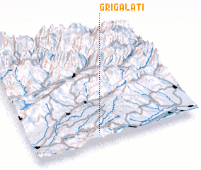 Places with similar names to Grigalatʼi, Georgia ::
// Gura Caliţei (RO)
// Karaçaltı (TR)
// Karagölet (TR)
// Kayrakaltı (TR)
// Kurklud (RU)
// Gorogled (MK)
// Kyrgauyldy (KZ)
// Keur Galadio (SN)
// Keur Galadio (SN)
// Caracolito (VE)
Disclaimer :: Information on this page comes without warranty of any kind |
||
|
Where is Grigalatʼi? Elevation and coordinates ::
Latitude (lat): 42°5'49"N Longitude (lon): 43°24'35"E
Elevation (approx.): 488m (map arrows pan, magnifying glasses zoom) |
||
|
Visiting Grigalatʼi? Hotel/Accommodation ::
Book a hotel in Grigalatʼi Travel Guide ::
Buy a travel guide for Georgia rental cars ::
car rental offers GPS waypoint ::
download a GPX waypoint (PoI) of Grigalatʼi for your GPS receiver
|
||