|
search place name
|
||
Gvedreti (Abashis Raioni, Georgia)Gvedreti is a town in the Abashis Raioni region of Georgia. An overview map of the region around Gvedreti is displayed below.
regional and 3d topo map of Gvedreti, Georgia ::
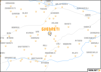
Nearby towns ::
Khvtse (1.4km south east) //
Urnuli (1.4km east) //
Okhera (2.3km south east) //
Velebi (4.0km north) //
Dre (3.6km west) //
Luli (4.5km south east) //
Peli (4.9km south) //
Didtavi (5.7km south) //
Didi Ateni (5.7km north) //
Degeula (5.7km north) //
Khandisi (4.5km south west) //
Patara Ateni (6.5km north) //
Gardateni (6.6km north) //
Ikvnevi (5.5km west) //
Nadarbazi (7.4km south) //
Avketi (6.0km north east) //
Dzhebiri (7.5km north) //
Gulkhandisi (7.5km south) //
Saqavre (6.4km south east) //
Zemo Akhalsopʼeli (8.6km south) //
Chanchakha (8.5km south west) //
Okiani (10.3km south west) //
[all distances 'as the bird flies' and approximate] 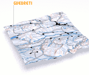 Places with similar names to Gvedreti, Georgia ::
// Kaft Rūd (IR)
Disclaimer :: Information on this page comes without warranty of any kind |
||
|
Where is Gvedreti? Elevation and coordinates ::
Latitude (lat): 41°52'0"N Longitude (lon): 44°7'0"E
Elevation (approx.): 1321m (map arrows pan, magnifying glasses zoom) |
||
|
Visiting Gvedreti? Hotel/Accommodation ::
Book a hotel in Gvedreti Travel Guide ::
Buy a travel guide for Georgia rental cars ::
car rental offers GPS waypoint ::
download a GPX waypoint (PoI) of Gvedreti for your GPS receiver
|
||