|
search place name
|
||
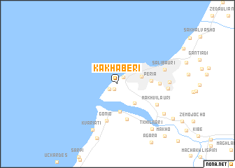
Kakhaberi (Georgia)Kakhaberi is a town in Georgia. An overview map of the region around Kakhaberi is displayed below.
regional and 3d topo map of Kakhaberi, Georgia ::
Kakhaberi airports ::
The nearest airport is TZX - Trabzon, located 167.3 km south west of Kakhaberi.
Other airports nearby include ERZ - Erzurum (189.2 km south), AER - Sochi (243.4 km north west), Nearby towns ::
Minda (0.9km south west) //
Angisa (1.2km north east) //
Adlia (1.3km south west) //
Bat'umi (3.1km east) //
Mejinistsqali (3.7km south east) //
Akhalsop'eli (4.4km south) //
P'eria (4.1km east) //
Charnali (5.8km south) //
Gonio (5.9km south) //
Mnat'obi (5.0km east) //
Makhvilauri (5.7km south east) //
Salibauri (6.0km east) //
Urekhi (6.1km east) //
K'veda Sameba (6.2km east) //
Kvariat'i (7.9km south) //
Sharabidzeebi (7.3km south east) //
T'khilnari (8.3km south east) //
Kvariat'i (9.0km south) //
Khelvach'auri (8.6km south east) //
Makho (10.0km south east) //
[all distances 'as the bird flies' and approximate]  Places with similar names to Kakhaberi, Georgia :: Disclaimer :: Information on this page comes without warranty of any kind |
||
|
Where is Kakhaberi? Elevation and coordinates ::
Latitude (lat): 41°37'42"N Longitude (lon): 41°36'11"E
Elevation (approx.): 4m (map arrows pan, magnifying glasses zoom) |
||
|
Visiting Kakhaberi? Hotel/Accommodation ::
Book a hotel in Kakhaberi Travel Guide ::
Buy a travel guide for Georgia rental cars ::
car rental offers GPS waypoint ::
download a GPX waypoint (PoI) of Kakhaberi for your GPS receiver
|
||