|
search place name
|
||
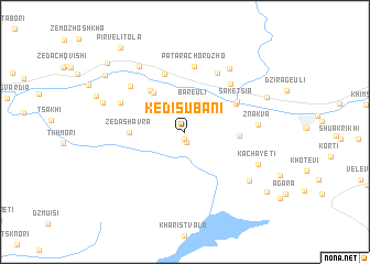
Kedisubani (Abashis Raioni, Georgia)Kedisubani is a town in the Abashis Raioni region of Georgia. An overview map of the region around Kedisubani is displayed below.
regional and 3d topo map of Kedisubani, Georgia ::
Kedisubani airports ::
The nearest airport is MRV - Mineralnye Vody Mineralnyye Vody, located 190.9 km north of Kedisubani.
Nearby towns ::
Namanevi (0.7km south) //
Khonchiori (1.0km south) //
Bareuli (3.0km north) //
Gorisubani (3.0km north) //
Shroma (2.7km north east) //
Abanoyeti (4.6km north west) //
Ghadishi (4.9km north west) //
Motkiari (4.1km east) //
Zeda-Shavra (4.2km west) //
Bugeuli (4.7km north east) //
Saketsia (5.0km north east) //
Khvanchkara (6.0km north) //
Kldisubani (5.9km north east) //
Bostana (5.9km north east) //
Patara-Chordzho (6.7km north) //
Didi-Chordzho (6.4km north east) //
Patara-Oni (5.6km north west) //
K'veda Shavra (6.2km north west) //
Znakva (5.5km east) //
Gviara (7.2km north east) //
Meore Tola (7.5km north west) //
Kachayeti (6.4km south east) //
Nikortsminda (6.9km south east) //
Tbeti (6.8km north west) //
Sadmeli (7.1km north east) //
Chrebalo (8.3km north west) //
Ukeshi (8.6km south east) //
K'vemo Zhoshkha (9.1km north west) //
Pirveli-Tola (9.8km north west) //
[all distances 'as the bird flies' and approximate]  Places with similar names to Kedisubani, Georgia ::
Disclaimer :: Information on this page comes without warranty of any kind |
||
|
Where is Kedisubani? Elevation and coordinates ::
Latitude (lat): 42°30'24"N Longitude (lon): 43°2'30"E
Elevation (approx.): 1033m (map arrows pan, magnifying glasses zoom) |
||
|
Visiting Kedisubani? Hotel/Accommodation ::
Book a hotel in Kedisubani Travel Guide ::
Buy a travel guide for Georgia rental cars ::
car rental offers GPS waypoint ::
download a GPX waypoint (PoI) of Kedisubani for your GPS receiver
|
||