|
search place name
|
||
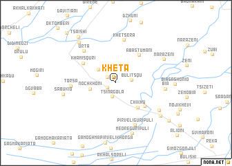
Kheta (Abashis Raioni, Georgia)Kheta is a town in the Abashis Raioni region of Georgia. An overview map of the region around Kheta is displayed below.
regional and 3d topo map of Kheta, Georgia ::
Kheta airports ::
The nearest airport is AER - Sochi, located 196.6 km north west of Kheta.
Other airports nearby include MRV - Mineralnye Vody Mineralnyye Vody (229.7 km north east), Nearby towns ::
Larchʼva (1.2km south west) //
Okhvamekari (1.3km north west) //
Tsinagola (2.3km south) //
Bulitsqu (1.9km east) //
Sakirio (2.9km north west) //
Nochkhoni (3.2km west) //
Chikhu (4.8km south east) //
Abastʼumani (5.2km north east) //
Khobi (5.2km south east) //
Khamisquri (5.0km north west) //
Khetsʼera (7.0km north) //
Urtʼa (6.3km north west) //
Tʼorsa (5.4km west) //
Pirveli-Guripuli (7.2km south) //
Bia (6.0km east) //
Napʼoshtu (6.8km south east) //
Meore Guripuli (8.4km south) //
Sabukio (6.5km west) //
Narazeni (6.9km north east) //
Tsʼatsʼkhvi (7.8km north west) //
Zeni (7.6km south east) //
Tsʼaishi (8.6km north west) //
Zemo Kʼvaloni (8.9km south east) //
Chkhoushi (10.0km north west) //
[all distances 'as the bird flies' and approximate] 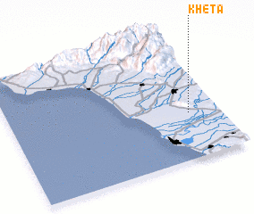 Places with similar names to Kheta, Georgia ::
Disclaimer :: Information on this page comes without warranty of any kind |
||
|
Where is Kheta? Elevation and coordinates ::
Latitude (lat): 42°21'41"N Longitude (lon): 41°51'17"E
Elevation (approx.): 72m (map arrows pan, magnifying glasses zoom) |
||
|
Visiting Kheta? Hotel/Accommodation ::
Book a hotel in Kheta Travel Guide ::
Buy a travel guide for Georgia rental cars ::
car rental offers GPS waypoint ::
download a GPX waypoint (PoI) of Kheta for your GPS receiver
|
||