|
search place name
|
||
Kʼvemo Khandaki (Abashis Raioni, Georgia)Kʼvemo Khandaki is a town in the Abashis Raioni region of Georgia. An overview map of the region around Kʼvemo Khandaki is displayed below.
regional and 3d topo map of Kʼvemo Khandaki, Georgia ::
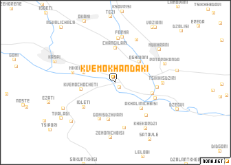
Nearby towns ::
Miriani (0.9km south east) //
Aghaiani (4.4km north east) //
Mikeltskaro (4.1km north west) //
Changilari (5.6km north) //
Kvemo-Chocheti (4.3km west) //
Akhali-Nichbisi (5.3km south east) //
Gomisdzhvari (6.1km south) //
Khidiskuri (4.9km east) //
Idleti (5.5km south west) //
Tʼelatʼgori (6.3km south) //
Sak'adagiano (5.1km east) //
Kʼsani (5.4km south east) //
Kebaani (5.4km west) //
Ferma (7.1km north) //
Saskhori (6.5km south east) //
Ferma (7.4km north) //
Kʼvemo Nichʼbisi (7.5km south) //
Tsikhisdziri (5.7km east) //
Vardisubani (7.4km north) //
Patara Kanda (6.7km north east) //
Mukhrani (7.5km north east) //
Khekordzi (8.3km south east) //
Kavtʼiskhevi (7.6km south west) //
Tsinarekhi (8.3km south west) //
Tvaladi (8.8km south west) //
[all distances 'as the bird flies' and approximate] 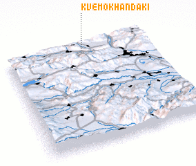 Places with similar names to Kʼvemo Khandaki, Georgia :: Disclaimer :: Information on this page comes without warranty of any kind |
||
|
Where is Kʼvemo Khandaki? Elevation and coordinates ::
Latitude (lat): 41°53'9"N Longitude (lon): 44°30'45"E
Elevation (approx.): 491m (map arrows pan, magnifying glasses zoom) |
||
|
Visiting Kʼvemo Khandaki? Hotel/Accommodation ::
Book a hotel in Kʼvemo Khandaki Travel Guide ::
Buy a travel guide for Georgia rental cars ::
car rental offers GPS waypoint ::
download a GPX waypoint (PoI) of Kʼvemo Khandaki for your GPS receiver
|
||