|
search place name
|
||
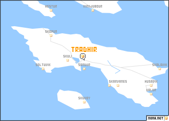
Traðir (Færøerne, Faroe Islands)Traðir is a town in the Færøerne region of Faroe Islands. An overview map of the region around Traðir is displayed below.
regional and 3d topo map of Traðir, Faroe Islands ::
Traðir airports ::
The nearest airport is FAE - Vagar, located 34.6 km north west of Traðir.
Nearby towns ::
Sandur (1.9km south) //
Skúli (1.7km west) //
Djúpidalur (6.1km south east) //
Skopun (6.6km north west) //
Skarvanes (6.6km south east) //
[all distances 'as the bird flies' and approximate] 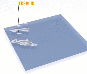 Places with similar names to Traðir, Faroe Islands ::
// Douar et Tahar (MA)
// Daridhar (BD)
// Tardhara (IN)
// Tor Dher (PK)
// Tordher (PK)
// Tor Dheri (PK)
// Tor Dheri (PK)
// Douar Dahar (MA)
Disclaimer :: Information on this page comes without warranty of any kind |
||
|
Where is Traðir? Elevation and coordinates ::
Latitude (lat): 61°51'0"N Longitude (lon): 6°48'0"W
(map arrows pan, magnifying glasses zoom) |
||
|
Visiting Traðir? Hotel/Accommodation ::
Book a hotel in Traðir Travel Guide ::
rental cars ::
car rental offers GPS waypoint ::
download a GPX waypoint (PoI) of Traðir for your GPS receiver
|
||