|
search place name
|
||
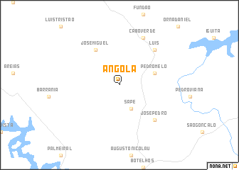
Angola (Minas Gerais, Brazil)Angola is a town in the Minas Gerais region of Brazil. An overview map of the region around Angola is displayed below.
regional and 3d topo map of Angola, Brazil ::
Angola airports ::
The nearest airport is POO - Pocos De Caldas, located 37.0 km south of Angola.
Other airports nearby include VAG - Varginha Major Brigadeiro Trompowsky (99.6 km east), QPS - Piracununga Campo Fontenelle (105.8 km south west), RAO - Ribeirao Preto Leite Lopes (145.9 km west), VCP - Campinas Viracopos (178.5 km south west), Nearby towns ::
Sapé (4.1km south east) //
Pedro Melo (5.5km east) //
José Miguel (6.5km north west) //
Luís (7.6km north east) //
José Pedro (7.6km south east) //
Cabo Verde (8.2km north east) //
[all distances 'as the bird flies' and approximate] 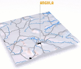 Places with similar names to Angola, Brazil ::
Disclaimer :: Information on this page comes without warranty of any kind |
||
|
Where is Angola? Elevation and coordinates ::
Latitude (lat): 21°32'0"S Longitude (lon): 46°26'0"W
Elevation (approx.): 894m (map arrows pan, magnifying glasses zoom) |
||
|
Visiting Angola? Hotel/Accommodation ::
Book a hotel in Angola Travel Guide ::
Buy a travel guide for Brazil rental cars ::
car rental offers GPS waypoint ::
download a GPX waypoint (PoI) of Angola for your GPS receiver
|
||