|
search place name
|
||
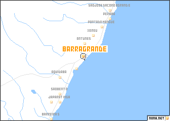
Barra Grande (Alagoas, Brazil)Barra Grande is a town in the Alagoas region of Brazil. An overview map of the region around Barra Grande is displayed below.
regional and 3d topo map of Barra Grande, Brazil ::
Barra Grande airports ::
The nearest airport is MCZ - Maceio Zumbi Dos Palmares, located 86.1 km south west of Barra Grande.
Other airports nearby include REC - Recife Guararapes Gilberto Freyre Intl (101.3 km north), CPV - Campina Grande Presidente Joao Suassuna (206.2 km north), JPA - Joao Pessoa Presidente Castro Pinto (206.6 km north), AJU - Aracaju Santa Maria (300.3 km south west), Nearby towns ::
 Places with similar names to Barra Grande, Brazil ::
// Beira Grande (PT)
// Barra Grande (BR)
// Barra Grande (BR)
// Barra Grande (BR)
// Barra Grande (BR)
// Barra Grande (BR)
// Barra Grande (BR)
// Barra Grande (BR)
// Barra Grande (BR)
// Barra Grande (BR)
Disclaimer :: Information on this page comes without warranty of any kind |
||
|
Where is Barra Grande? Elevation and coordinates ::
Latitude (lat): 9°0'0"S Longitude (lon): 35°12'0"W
Elevation (approx.): -32768m (map arrows pan, magnifying glasses zoom) |
||
|
Visiting Barra Grande? Hotel/Accommodation ::
Book a hotel in Barra Grande Travel Guide ::
Buy a travel guide for Brazil rental cars ::
car rental offers GPS waypoint ::
download a GPX waypoint (PoI) of Barra Grande for your GPS receiver
|
||