|
search place name
|
||
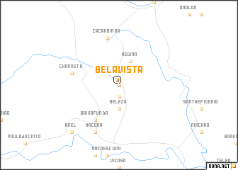
Bela Vista (Alagoas, Brazil)Bela Vista is a town in the Alagoas region of Brazil. An overview map of the region around Bela Vista is displayed below.
regional and 3d topo map of Bela Vista, Brazil ::
Bela Vista airports ::
The nearest airport is MCZ - Maceio Zumbi Dos Palmares, located 54.6 km south east of Bela Vista.
Other airports nearby include REC - Recife Guararapes Gilberto Freyre Intl (192.7 km north east), AJU - Aracaju Santa Maria (209.3 km south west), Nearby towns ::
Erva de Rato (0.0km north) //
Pendurão (1.9km south) //
Recanto (1.9km south) //
Beleza (3.7km south) //
Medina (4.1km north east) //
Baixa Funda (6.7km south west) //
Caçambinha (7.6km north) //
Chã Preta (7.5km west) //
Macena (8.3km south west) //
Anel (10.4km south west) //
[all distances 'as the bird flies' and approximate]  Places with similar names to Bela Vista, Brazil ::
// Belfast (JM)
// Bellavista (PE)
// Belle Vista (US)
// Bluff City (US)
// Blue Vista (US)
// Belfast (US)
// Bella Vista (US)
// Bella Vista (US)
// Bluff City (US)
// Belfast (US)
Disclaimer :: Information on this page comes without warranty of any kind |
||
|
Where is Bela Vista? Elevation and coordinates ::
Latitude (lat): 9°17'0"S Longitude (lon): 36°14'0"W
Elevation (approx.): 426m (map arrows pan, magnifying glasses zoom) |
||
|
Visiting Bela Vista? Hotel/Accommodation ::
Book a hotel in Bela Vista Travel Guide ::
Buy a travel guide for Brazil rental cars ::
car rental offers GPS waypoint ::
download a GPX waypoint (PoI) of Bela Vista for your GPS receiver
|
||