|
search place name
|
||
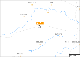
Cajá (Paraíba, Brazil)Cajá is a town in the Paraíba region of Brazil. An overview map of the region around Cajá is displayed below.
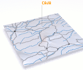
regional and 3d topo map of Cajá, Brazil ::
Cajá airports ::
The nearest airport is JPA - Joao Pessoa Presidente Castro Pinto, located 47.9 km east of Cajá.
Other airports nearby include CPV - Campina Grande Presidente Joao Suassuna (57.5 km west), REC - Recife Guararapes Gilberto Freyre Intl (116.0 km south east), NAT - Natal Augusto Severo (141.5 km north), Nearby towns ::
 Places with similar names to Cajá, Brazil ::
Disclaimer :: Information on this page comes without warranty of any kind |
||
|
Where is Cajá? Elevation and coordinates ::
Latitude (lat): 7°11'0"S Longitude (lon): 35°23'0"W
Elevation (approx.): 105m (map arrows pan, magnifying glasses zoom) |
||
|
Visiting Cajá? Hotel/Accommodation ::
Book a hotel in Cajá Travel Guide ::
Buy a travel guide for Brazil rental cars ::
car rental offers GPS waypoint ::
download a GPX waypoint (PoI) of Cajá for your GPS receiver
|
||