|
search place name
|
||
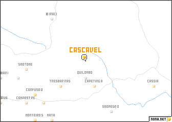
Cascavel (Minas Gerais, Brazil)Cascavel is a town in the Minas Gerais region of Brazil. An overview map of the region around Cascavel is displayed below.
regional and 3d topo map of Cascavel, Brazil ::
Cascavel airports ::
The nearest airport is RAO - Ribeirao Preto Leite Lopes, located 98.0 km south west of Cascavel.
Other airports nearby include UBA - Uberaba (127.9 km north west), POO - Pocos De Caldas (152.2 km south), QPS - Piracununga Campo Fontenelle (161.3 km south), AQA - Araracuara Araraquara (178.3 km south west), Nearby towns ::
Quilombo (3.7km south) //
Capetinga (5.8km south) //
Três Barras (7.6km south west) //
[all distances 'as the bird flies' and approximate] 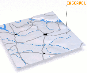 Places with similar names to Cascavel, Brazil ::
Disclaimer :: Information on this page comes without warranty of any kind |
||
|
Where is Cascavel? Elevation and coordinates ::
Latitude (lat): 20°33'0"S Longitude (lon): 47°4'0"W
Elevation (approx.): 1139m (map arrows pan, magnifying glasses zoom) |
||
|
Visiting Cascavel? Hotel/Accommodation ::
Book a hotel in Cascavel Travel Guide ::
Buy a travel guide for Brazil rental cars ::
car rental offers GPS waypoint ::
download a GPX waypoint (PoI) of Cascavel for your GPS receiver
|
||