|
search place name
|
||
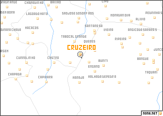
Cruzeiro (Piauí, Brazil)Cruzeiro is a town in the Piauí region of Brazil. An overview map of the region around Cruzeiro is displayed below.
regional and 3d topo map of Cruzeiro, Brazil ::
Cruzeiro airports ::
The nearest airport is THE - Teresina Senador Petronio Portella, located 131.4 km south of Cruzeiro.
Other airports nearby include SLZ - Sao Luis Marechal Cunha Machado Intl (250.6 km north west), Nearby towns ::
Canto da Parnaíba (2.0km south east) //
Santa Maria (2.9km west) //
Queres (3.3km north east) //
Garrafão (3.5km north east) //
Tabocal Grande (4.2km north) //
Engano (4.3km south east) //
Buriti (5.4km east) //
Marajá (5.6km south) //
Castro (6.4km west) //
Faveira (6.5km north east) //
Santa Rosa (7.0km north east) //
Malhada de Pedra (7.3km south east) //
Gameleira (8.2km west) //
Vieira (8.3km north east) //
Chapada da Sindá (8.3km north) //
São Raimundo (9.3km north west) //
Capivara (9.8km south west) //
Cajazeiras (10.3km south east) //
[all distances 'as the bird flies' and approximate] 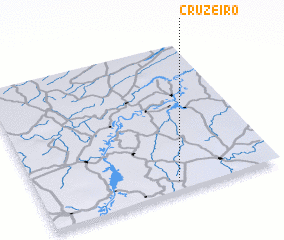 Places with similar names to Cruzeiro, Brazil ::
Disclaimer :: Information on this page comes without warranty of any kind |
||
|
Where is Cruzeiro? Elevation and coordinates ::
Latitude (lat): 3°56'25"S Longitude (lon): 42°25'34"W
Elevation (approx.): 110m (map arrows pan, magnifying glasses zoom) |
||
|
Visiting Cruzeiro? Hotel/Accommodation ::
Book a hotel in Cruzeiro Travel Guide ::
Buy a travel guide for Brazil rental cars ::
car rental offers GPS waypoint ::
download a GPX waypoint (PoI) of Cruzeiro for your GPS receiver
|
||