|
search place name
|
||
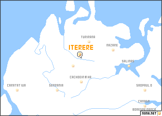
Itererê (Maranhão, Brazil)Itererê is a town in the Maranhão region of Brazil. An overview map of the region around Itererê is displayed below.
regional and 3d topo map of Itererê, Brazil ::
Itererê airports ::
The nearest airport is SLZ - Sao Luis Marechal Cunha Machado Intl, located 148.2 km south east of Itererê.
Nearby towns ::
Ponta Sêca (2.6km south west) //
Turirana (4.1km north east) //
Cachoeirinha (5.6km south) //
Nazaré (7.6km east) //
Serrania (9.3km south west) //
[all distances 'as the bird flies' and approximate] 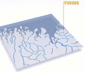 Places with similar names to Itererê, Brazil ::
Disclaimer :: Information on this page comes without warranty of any kind |
||
|
Where is Itererê? Elevation and coordinates ::
Latitude (lat): 1°34'0"S Longitude (lon): 45°6'0"W
Elevation (approx.): 22m (map arrows pan, magnifying glasses zoom) |
||
|
Visiting Itererê? Hotel/Accommodation ::
Book a hotel in Itererê Travel Guide ::
Buy a travel guide for Brazil rental cars ::
car rental offers GPS waypoint ::
download a GPX waypoint (PoI) of Itererê for your GPS receiver
|
||