|
search place name
|
||
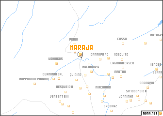
Marajá (Maranhão, Brazil)Marajá is a town in the Maranhão region of Brazil. An overview map of the region around Marajá is displayed below.
regional and 3d topo map of Marajá, Brazil ::
Marajá airports ::
The nearest airport is SLZ - Sao Luis Marechal Cunha Machado Intl, located 102.3 km north west of Marajá.
Nearby towns ::
Brandura (2.1km north west) //
Queimada II (2.2km south east) //
Pequi (3.5km north west) //
Macambira (3.9km south east) //
Deserto II (4.0km south) //
Garamparo (4.3km east) //
Quirina (5.2km south) //
Domingos (5.9km west) //
Cocal V (6.2km east) //
Canto Grande (6.7km south) //
Cocalinho (7.0km south) //
Baixão I (7.0km south west) //
Pirinã II (7.2km south east) //
Guarimanzal (8.1km south west) //
Barra da Prata (8.5km south east) //
Estiva da Josefa (8.6km south) //
Mesqueira (8.7km south west) //
Riachinho (9.4km south east) //
Cascudo (10.2km south east) //
[all distances 'as the bird flies' and approximate] 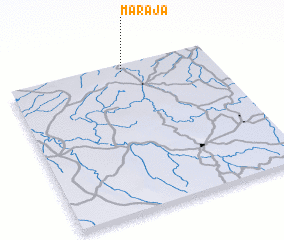 Places with similar names to Marajá, Brazil ::
Disclaimer :: Information on this page comes without warranty of any kind |
||
|
Where is Marajá? Elevation and coordinates ::
Latitude (lat): 3°2'47"S Longitude (lon): 43°26'10"W
Elevation (approx.): 80m (map arrows pan, magnifying glasses zoom) |
||
|
Visiting Marajá? Hotel/Accommodation ::
Book a hotel in Marajá Travel Guide ::
Buy a travel guide for Brazil rental cars ::
car rental offers GPS waypoint ::
download a GPX waypoint (PoI) of Marajá for your GPS receiver
|
||