|
search place name
|
||
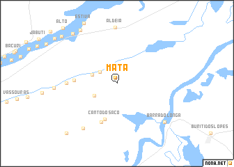
Mata (Maranhão, Brazil)Mata is a town in the Maranhão region of Brazil. An overview map of the region around Mata is displayed below.
regional and 3d topo map of Mata, Brazil ::
Mata airports ::
The nearest airport is THE - Teresina Senador Petronio Portella, located 235.7 km south west of Mata.
Nearby towns ::
Alagoinha (3.3km north west) //
Baixão do Centro (4.1km south west) //
Água Branca (4.2km west) //
Canto do Saco (6.0km south) //
Mocambo de Baixo (6.7km south west) //
Palmeirinha II (6.8km west) //
Estreito (8.1km west) //
Mocambo de Cima (9.0km south west) //
Barra do Longá (9.8km south east) //
Olho-dʼÁgua (10.3km north west) //
Novo Oriente (10.6km north west) //
Pau Ferrado (11.3km south west) //
Lavajinha (11.6km north west) //
[all distances 'as the bird flies' and approximate] 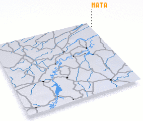 Places with similar names to Mata, Brazil ::
Disclaimer :: Information on this page comes without warranty of any kind |
||
|
Where is Mata? Elevation and coordinates ::
Latitude (lat): 3°5'41"S Longitude (lon): 42°0'6"W
Elevation (approx.): 44m (map arrows pan, magnifying glasses zoom) |
||
|
Visiting Mata? Hotel/Accommodation ::
Book a hotel in Mata Travel Guide ::
Buy a travel guide for Brazil rental cars ::
car rental offers GPS waypoint ::
download a GPX waypoint (PoI) of Mata for your GPS receiver
|
||