|
search place name
|
||
Morro de Pedra (Maranhão, Brazil)Morro de Pedra is a town in the Maranhão region of Brazil. An overview map of the region around Morro de Pedra is displayed below.
regional and 3d topo map of Morro de Pedra, Brazil ::
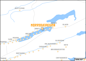
Nearby towns ::
Lavajinha (1.2km east) //
Sambaiba I (1.2km north west) //
Melancia (1.6km south west) //
Alto (2.2km north east) //
Jabuti (2.5km west) //
Santa Maria (3.0km south west) //
Novo Oriente (3.0km east) //
Olho-dʼÁgua (4.4km east) //
São Domingos (4.5km south west) //
Lavagem dos Patos (4.5km west) //
Estiva (5.4km north east) //
Jiquiri (6.1km south west) //
Angelim (6.5km west) //
Bacuri (6.8km west) //
Estreito (7.4km south) //
Palmeirinha II (7.4km south east) //
Mundo Novo (7.7km south west) //
Candeias (8.0km south) //
Água Branca (8.4km south east) //
Salgadinho (8.5km west) //
Curral do Meio (9.0km south) //
Alagoinha (9.1km south east) //
Grossos (9.4km south west) //
[all distances 'as the bird flies' and approximate] 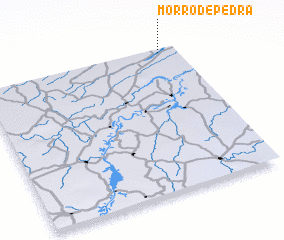 Places with similar names to Morro de Pedra, Brazil ::
Disclaimer :: Information on this page comes without warranty of any kind |
||
|
Where is Morro de Pedra? Elevation and coordinates ::
Latitude (lat): 3°1'47"S Longitude (lon): 42°5'31"W
Elevation (approx.): 16m (map arrows pan, magnifying glasses zoom) |
||
|
Visiting Morro de Pedra? Hotel/Accommodation ::
Book a hotel in Morro de Pedra Travel Guide ::
Buy a travel guide for Brazil rental cars ::
car rental offers GPS waypoint ::
download a GPX waypoint (PoI) of Morro de Pedra for your GPS receiver
|
||