|
search place name
|
||
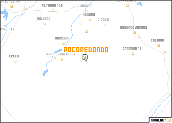
Poço Redondo (Rio Grande do Norte, Brazil)Poço Redondo is a town in the Rio Grande do Norte region of Brazil. An overview map of the region around Poço Redondo is displayed below.
regional and 3d topo map of Poço Redondo, Brazil ::
Poço Redondo airports ::
The nearest airport is CPV - Campina Grande Presidente Joao Suassuna, located 203.0 km south east of Poço Redondo.
Other airports nearby include NAT - Natal Augusto Severo (215.1 km east), Nearby towns ::
Riacho da Oiticica (5.3km west) //
Ouricuri (6.4km north west) //
Gavião (6.5km north) //
Poço Verde (6.7km west) //
Malhada Redonda (7.8km west) //
Nova Olinda (8.3km north) //
Pipôco (8.9km north east) //
[all distances 'as the bird flies' and approximate] 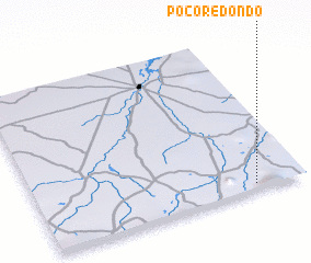 Places with similar names to Poço Redondo, Brazil ::
// Poço Redondo (BR)
// Poço Redondo (BR)
// Poço Redondo (BR)
// Poço Redondo (BR)
// Poço Redondo (PT)
// Poggiridenti (IT)
// Poço Redondo (BR)
// Pago Redondo (AR)
Disclaimer :: Information on this page comes without warranty of any kind |
||
|
Where is Poço Redondo? Elevation and coordinates ::
Latitude (lat): 5°58'0"S Longitude (lon): 37°11'23"W
Elevation (approx.): 155m (map arrows pan, magnifying glasses zoom) |
||
|
Visiting Poço Redondo? Hotel/Accommodation ::
Book a hotel in Poço Redondo Travel Guide ::
Buy a travel guide for Brazil rental cars ::
car rental offers GPS waypoint ::
download a GPX waypoint (PoI) of Poço Redondo for your GPS receiver
|
||