|
search place name
|
||
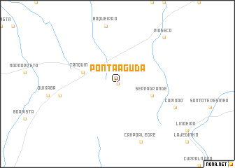
Ponta Aguda (Bahia, Brazil)Ponta Aguda is a town in the Bahia region of Brazil. An overview map of the region around Ponta Aguda is displayed below.
regional and 3d topo map of Ponta Aguda, Brazil ::
Ponta Aguda airports ::
The nearest airport is SSA - Salvador Deputado Luis Eduardo Magalhaes, located 146.6 km east of Ponta Aguda.
Nearby towns ::
Lajedo (0.0km north) //
Serra Grande (5.7km east) //
Tanquinho (5.7km west) //
Rio Sêco (10.4km north east) //
[all distances 'as the bird flies' and approximate]  Places with similar names to Ponta Aguda, Brazil ::
// Ponte Caída (BR)
// Pontikátai (GR)
// Pāndikkād (IN)
// Pentakota (IN)
// Pintukota (ID)
// Pindi Kot (PK)
// Punta Ocote (HN)
// Pontgot (HT)
// Pondokdua (ID)
// Pandukot (PH)
Disclaimer :: Information on this page comes without warranty of any kind |
||
|
Where is Ponta Aguda? Elevation and coordinates ::
Latitude (lat): 12°43'0"S Longitude (lon): 39°40'0"W
Elevation (approx.): 353m (map arrows pan, magnifying glasses zoom) |
||
|
Visiting Ponta Aguda? Hotel/Accommodation ::
Book a hotel in Ponta Aguda Travel Guide ::
Buy a travel guide for Brazil rental cars ::
car rental offers GPS waypoint ::
download a GPX waypoint (PoI) of Ponta Aguda for your GPS receiver
|
||