|
search place name
|
||
Pouso Alegre (Bahia, Brazil)Pouso Alegre is a town in the Bahia region of Brazil. An overview map of the region around Pouso Alegre is displayed below.
regional and 3d topo map of Pouso Alegre, Brazil ::

Pouso Alegre airports ::
The nearest airport is SSA - Salvador Deputado Luis Eduardo Magalhaes, located 87.5 km east of Pouso Alegre.
Other airports nearby include IOS - Ilheus (219.6 km south), Nearby towns ::
Casmorra (1.8km east) //
Bela Vista (1.8km west) //
Boa Vista (2.6km south east) //
Campo Formoso (2.6km north west) //
Sobradinho (3.6km east) //
São Filipe (4.1km south east) //
Caboclo (4.1km south east) //
Mombaça (5.2km north west) //
Mutum (5.6km south) //
Ilhota de Cima (5.6km south) //
Jacarandá (5.8km south) //
Bom Sucesso (6.6km north west) //
Dom Macedo Costa (7.6km south) //
Caraípe (7.8km north east) //
Conceição do Almeida (8.1km north west) //
Água Branca (9.1km north west) //
[all distances 'as the bird flies' and approximate] 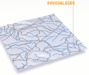 Places with similar names to Pouso Alegre, Brazil ::
// Pouso Alegre (BR)
// Pouso Alegre (BR)
// Pouso Alegre (BR)
// Pouso Alegre (BR)
// Pouso Alegre (BR)
// Pouso Alegre (BR)
// Pouso Alegre (BR)
// Paso el Cura (VE)
// Pouso Alegre (BR)
// Pozla Gora (HR)
Disclaimer :: Information on this page comes without warranty of any kind |
||
|
Where is Pouso Alegre? Elevation and coordinates ::
Latitude (lat): 12°50'0"S Longitude (lon): 39°8'0"W
Elevation (approx.): 207m (map arrows pan, magnifying glasses zoom) |
||
|
Visiting Pouso Alegre? Hotel/Accommodation ::
Book a hotel in Pouso Alegre Travel Guide ::
Buy a travel guide for Brazil rental cars ::
car rental offers GPS waypoint ::
download a GPX waypoint (PoI) of Pouso Alegre for your GPS receiver
|
||