|
search place name
|
||
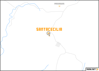
Santa Cecília (Santa Catarina, Brazil)Santa Cecília is a town in the Santa Catarina region of Brazil. An overview map of the region around Santa Cecília is displayed below.
regional and 3d topo map of Santa Cecília, Brazil ::
Santa Cecília airports ::
The nearest airport is NVT - Navegantes Ministro Victor Konder Intl, located 178.8 km east of Santa Cecília.
Other airports nearby include JOI - Joinville Lauro Carneiro De Loyola (182.4 km north east), CWB - Curitiba Afonso Pena (201.1 km north east), FLN - Florianopolis Hercilio Luz (205.3 km south east), BFH - Curitiba Bacacheri (208.5 km north east), Nearby towns ::
Sepultura (NaNkm north) //
[all distances 'as the bird flies' and approximate] 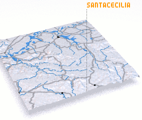 Places with similar names to Santa Cecília, Brazil ::
// Santa Cecília (BR)
// Santa Cecília (BR)
// Santa Cecilia (IT)
// Santa Cecilia (CU)
// Santa Cecilia (CU)
// Santa Cecilia (ES)
// Santa Cecilia (ES)
// Santa Cecilia (ES)
// Santa Cecilia (CO)
// Santa Cecilia (CO)
Disclaimer :: Information on this page comes without warranty of any kind |
||
|
Where is Santa Cecília? Elevation and coordinates ::
Latitude (lat): 26°56'0"S Longitude (lon): 50°27'0"W
Elevation (approx.): 1008m (map arrows pan, magnifying glasses zoom) |
||
|
Visiting Santa Cecília? Hotel/Accommodation ::
Book a hotel in Santa Cecília Travel Guide ::
Buy a travel guide for Brazil rental cars ::
car rental offers GPS waypoint ::
download a GPX waypoint (PoI) of Santa Cecília for your GPS receiver
|
||