|
search place name
|
||
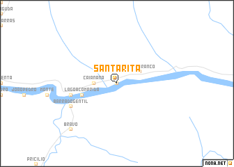
Santa Rita (Bahia, Brazil)Santa Rita is a town in the Bahia region of Brazil. An overview map of the region around Santa Rita is displayed below.
regional and 3d topo map of Santa Rita, Brazil ::
Santa Rita airports ::
The nearest airport is IOS - Ilheus, located 186.9 km south east of Santa Rita.
Nearby towns ::
Riacho do Caldeirão (0.0km north) //
Caianana (3.6km west) //
Monte Branco (4.0km north east) //
Lagoa Comprida (5.7km west) //
Espinha (7.4km west) //
Barra do Gentil (8.1km south west) //
Bravo (10.3km south west) //
[all distances 'as the bird flies' and approximate] 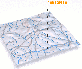 Places with similar names to Santa Rita, Brazil ::
// Santa Rita (BR)
// Santa Rita (BR)
// Santa Rita (BR)
// Santa Rita (BR)
// Santa Rita (BR)
// Santa Rita (BR)
// Santa Rita (BR)
// Santa Rita (BR)
// Santa Rita (BR)
// Santa Rita (BR)
Disclaimer :: Information on this page comes without warranty of any kind |
||
|
Where is Santa Rita? Elevation and coordinates ::
Latitude (lat): 13°52'0"S Longitude (lon): 40°28'0"W
Elevation (approx.): 251m (map arrows pan, magnifying glasses zoom) |
||
|
Visiting Santa Rita? Hotel/Accommodation ::
Book a hotel in Santa Rita Travel Guide ::
Buy a travel guide for Brazil rental cars ::
car rental offers GPS waypoint ::
download a GPX waypoint (PoI) of Santa Rita for your GPS receiver
|
||