|
search place name
|
||
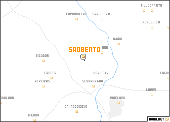
São Bento (São Paulo, Brazil)São Bento is a town in the São Paulo region of Brazil. An overview map of the region around São Bento is displayed below.
regional and 3d topo map of São Bento, Brazil ::
São Bento airports ::
The nearest airport is QPS - Piracununga Campo Fontenelle, located 46.9 km north east of São Bento.
Other airports nearby include AQA - Araracuara Araraquara (77.2 km north west), VCP - Campinas Viracopos (91.1 km south east), POO - Pocos De Caldas (120.3 km north east), RAO - Ribeirao Preto Leite Lopes (131.9 km north), Nearby towns ::
Eritréia (3.9km north east) //
Boa Vista (5.0km south east) //
Serra dʼÁgua (5.8km south) //
Cabeça (7.8km south west) //
Ajapi (7.8km north east) //
[all distances 'as the bird flies' and approximate] 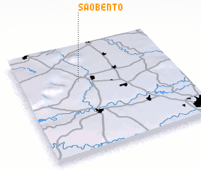 Places with similar names to São Bento, Brazil ::
Disclaimer :: Information on this page comes without warranty of any kind |
||
|
Where is São Bento? Elevation and coordinates ::
Latitude (lat): 22°19'0"S Longitude (lon): 47°37'0"W
Elevation (approx.): 615m (map arrows pan, magnifying glasses zoom) |
||
|
Visiting São Bento? Hotel/Accommodation ::
Book a hotel in São Bento Travel Guide ::
Buy a travel guide for Brazil rental cars ::
car rental offers GPS waypoint ::
download a GPX waypoint (PoI) of São Bento for your GPS receiver
|
||