|
search place name
|
||
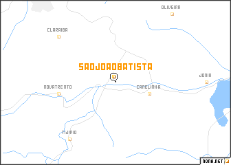
São João Batista (Santa Catarina, Brazil)São João Batista is a town in the Santa Catarina region of Brazil. An overview map of the region around São João Batista is displayed below.
regional and 3d topo map of São João Batista, Brazil ::
São João Batista airports ::
The nearest airport is NVT - Navegantes Ministro Victor Konder Intl, located 46.5 km north east of São João Batista.
Other airports nearby include FLN - Florianopolis Hercilio Luz (52.9 km south east), JOI - Joinville Lauro Carneiro De Loyola (115.5 km north), CWB - Curitiba Afonso Pena (195.6 km north), BFH - Curitiba Bacacheri (210.1 km north), Nearby towns ::
Canelinha (5.3km east) //
[all distances 'as the bird flies' and approximate] 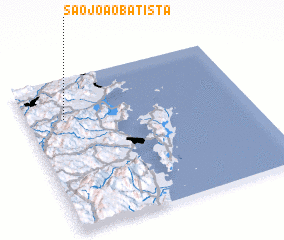 Places with similar names to São João Batista, Brazil ::
// São João Batista (PT)
// São João Batista (BR)
Disclaimer :: Information on this page comes without warranty of any kind |
||
|
Where is São João Batista? Elevation and coordinates ::
Latitude (lat): 27°16'0"S Longitude (lon): 48°50'0"W
Elevation (approx.): 16m (map arrows pan, magnifying glasses zoom) |
||
|
Visiting São João Batista? Hotel/Accommodation ::
Book a hotel in São João Batista Travel Guide ::
Buy a travel guide for Brazil rental cars ::
car rental offers GPS waypoint ::
download a GPX waypoint (PoI) of São João Batista for your GPS receiver
|
||