|
search place name
|
||
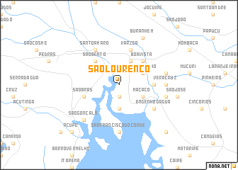
São Lourenço (Bahia, Brazil)São Lourenço is a town in the Bahia region of Brazil. An overview map of the region around São Lourenço is displayed below.
regional and 3d topo map of São Lourenço, Brazil ::
São Lourenço airports ::
The nearest airport is SSA - Salvador Deputado Luis Eduardo Magalhaes, located 52.7 km south east of São Lourenço.
Other airports nearby include AJU - Aracaju Santa Maria (249.4 km north east), Nearby towns ::
Campinas (1.9km south) //
São Bento das Lajes (3.7km south) //
São Caetano (4.1km north east) //
Desempenho (4.1km north east) //
Macaco (4.1km south east) //
Boa Vista (5.2km north east) //
São Bento (5.2km north west) //
Conquista (5.4km east) //
Várzea (5.8km north) //
São Brás (5.7km west) //
Santo Amaro (6.6km north west) //
Engenho dʼÁgua (6.6km south east) //
Vera Cruz (7.2km east) //
São Francisco do Conde (7.4km south) //
Vera Cruz (7.5km east) //
Cassarangongo (7.5km east) //
São Gonçalo (7.8km south west) //
Buranhém (8.2km north east) //
Monte Recôncavo (10.4km south east) //
Acupe (10.4km south west) //
[all distances 'as the bird flies' and approximate] 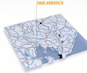 Places with similar names to São Lourenço, Brazil ::
// São Lourenço (BR)
// São Lourenço (BR)
// São Lourenço (BR)
// São Lourenço (BR)
// São Lourenço (BR)
// São Lourenço (BR)
// São Lourenço (BR)
// São Lourenço (BR)
// São Lourenço (BR)
// São Lourenço (BR)
Disclaimer :: Information on this page comes without warranty of any kind |
||
|
Where is São Lourenço? Elevation and coordinates ::
Latitude (lat): 12°35'0"S Longitude (lon): 38°41'0"W
Elevation (approx.): 29m (map arrows pan, magnifying glasses zoom) |
||
|
Visiting São Lourenço? Hotel/Accommodation ::
Book a hotel in São Lourenço Travel Guide ::
Buy a travel guide for Brazil rental cars ::
car rental offers GPS waypoint ::
download a GPX waypoint (PoI) of São Lourenço for your GPS receiver
|
||