|
search place name
|
||
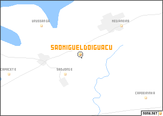
São Miguel do Iguaçu (Parana, Brazil)São Miguel do Iguaçu is a town in the Parana region of Brazil. An overview map of the region around São Miguel do Iguaçu is displayed below.
regional and 3d topo map of São Miguel do Iguaçu, Brazil ::
São Miguel do Iguaçu airports ::
The nearest airport is IGU - Foz Do Iguacu Cataratas Intl, located 42.2 km south west of São Miguel do Iguaçu.
Other airports nearby include IGR - Iguazu Falls Cataratas Del Iguazu (52.8 km south west), CAC - Cascavel (77.5 km north east), XAP - Chapeco (248.7 km south east), Nearby towns ::
São Jorge (5.0km south west) //
[all distances 'as the bird flies' and approximate]  Places with similar names to São Miguel do Iguaçu, Brazil :: Disclaimer :: Information on this page comes without warranty of any kind |
||
|
Where is São Miguel do Iguaçu? Elevation and coordinates ::
Latitude (lat): 25°21'0"S Longitude (lon): 54°10'0"W
Elevation (approx.): 314m (map arrows pan, magnifying glasses zoom) |
||
|
Visiting São Miguel do Iguaçu? Hotel/Accommodation ::
Book a hotel in São Miguel do Iguaçu Travel Guide ::
Buy a travel guide for Brazil rental cars ::
car rental offers GPS waypoint ::
download a GPX waypoint (PoI) of São Miguel do Iguaçu for your GPS receiver
|
||