|
search place name
|
||
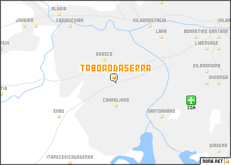
Taboão da Serra (São Paulo, Brazil)Taboão da Serra is a town in the São Paulo region of Brazil. An overview map of the region around Taboão da Serra is displayed below.
regional and 3d topo map of Taboão da Serra, Brazil ::
Taboão da Serra airports ::
The nearest airport is CGH - Sao Paulo Congonhas, located 11.7 km east of Taboão da Serra.
Other airports nearby include GRU - Sao Paulo Guarulhos Gov Andre Franco Montouro (35.6 km north east), SSZ - Base Aerea De Santos (60.7 km south east), VCP - Campinas Viracopos (75.7 km north west), SJK - Sao Jose Dos Campos Professor Urbano Ernesto Stumpf (101.1 km north east), Nearby towns ::
Campo Limpo (3.7km south) //
Osasco (4.1km north west) //
Santo Amaro (8.8km south east) //
Lapa (10.1km north east) //
[all distances 'as the bird flies' and approximate] 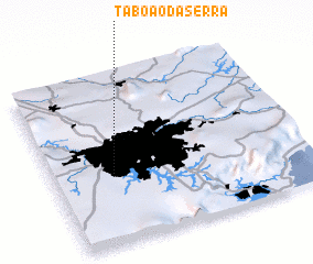 Places with similar names to Taboão da Serra, Brazil :: Disclaimer :: Information on this page comes without warranty of any kind |
||
|
Where is Taboão da Serra? Elevation and coordinates ::
Latitude (lat): 23°36'0"S Longitude (lon): 46°46'0"W
Elevation (approx.): 783m (map arrows pan, magnifying glasses zoom) |
||
|
Visiting Taboão da Serra? Hotel/Accommodation ::
Book a hotel in Taboão da Serra Travel Guide ::
Buy a travel guide for Brazil rental cars ::
car rental offers GPS waypoint ::
download a GPX waypoint (PoI) of Taboão da Serra for your GPS receiver
|
||