|
search place name
|
||
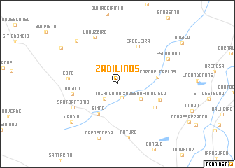
Zadilinos (Rio Grande do Norte, Brazil)Zadilinos is a town in the Rio Grande do Norte region of Brazil. An overview map of the region around Zadilinos is displayed below.
regional and 3d topo map of Zadilinos, Brazil ::
Zadilinos airports ::
The nearest airport is NAT - Natal Augusto Severo, located 202.0 km east of Zadilinos.
Other airports nearby include CPV - Campina Grande Presidente Joao Suassuna (240.8 km south east), FOR - Fortaleza Pinto Martins Intl (246.9 km north west), Nearby towns ::
São Pedro (2.3km south) //
Talhado (3.1km south west) //
Baixa de São Francisco (4.4km south east) //
Simão (5.7km south west) //
Coronel Carlos (6.5km east) //
Cabeleira (6.8km north east) //
Bom Lugar (7.0km south east) //
Três Bôcas (7.2km east) //
Angico (7.3km west) //
Cotó (7.9km west) //
Santo Antonio (8.0km south west) //
Umbuzeiro (8.3km north west) //
Futuro (8.7km south) //
Escondido (9.0km north east) //
Carne Gorda (9.1km south) //
Pau dʼArco (9.5km north west) //
Janduí (9.5km south west) //
[all distances 'as the bird flies' and approximate]  Places with similar names to Zadilinos, Brazil ::
Disclaimer :: Information on this page comes without warranty of any kind |
||
|
Where is Zadilinos? Elevation and coordinates ::
Latitude (lat): 5°23'28"S Longitude (lon): 36°59'45"W
Elevation (approx.): 77m (map arrows pan, magnifying glasses zoom) |
||
|
Visiting Zadilinos? Hotel/Accommodation ::
Book a hotel in Zadilinos Travel Guide ::
Buy a travel guide for Brazil rental cars ::
car rental offers GPS waypoint ::
download a GPX waypoint (PoI) of Zadilinos for your GPS receiver
|
||