|
search place name
|
||
Ahépé (Togo)Ahépé is a town in Togo. An overview map of the region around Ahépé is displayed below.
regional and 3d topo map of Ahépé, Togo ::

Ahépé airports ::
The nearest airport is LFW - Lome Gnassingbe Eyadema Intl, located 50.7 km south of Ahépé.
Other airports nearby include COO - Cotonou Cadjehoun (112.1 km east), ACC - Accra Kotoka Intl (205.4 km south west), LOS - Lagos Murtala Muhammed (212.5 km east), Nearby towns ::
Ahépé Assiko (0.0km north) //
Ahépé Pokli (1.8km west) //
Ahépé Akposso (1.8km west) //
Ahépé Rhekpoui (1.9km north) //
Ahépé Agbléta (1.8km east) //
Ahépé Kpoula (1.9km south) //
Dzafi (2.6km north west) //
Ahépé Nouatché (2.6km south west) //
Kouvé Gboli (5.6km north) //
Essé Nadjé (5.8km west) //
Zoumé (6.7km south east) //
Essé Zogbedji (7.6km west) //
Paté Diyogbé (7.6km north) //
Kouvé (7.6km north) //
Kouvé Atran (7.6km north) //
Adjiré Kouba Kondji (7.8km south east) //
Kodji Kopé (8.3km south east) //
Adjirékopé (8.3km south east) //
Rhodémi (8.3km south west) //
Tchekpo Dédékpoé (8.3km south west) //
Koudjonou (8.2km north east) //
Dékou Kopé (9.2km north east) //
[all distances 'as the bird flies' and approximate] 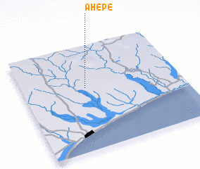
Disclaimer :: Information on this page comes without warranty of any kind |
||
|
Where is Ahépé? Elevation and coordinates ::
Latitude (lat): 6°36'0"N Longitude (lon): 1°24'0"E
Elevation (approx.): 132m (map arrows pan, magnifying glasses zoom) |
||
|
Visiting Ahépé? Hotel/Accommodation ::
Book a hotel in Ahépé Travel Guide ::
Buy a travel guide for Togo rental cars ::
car rental offers GPS waypoint ::
download a GPX waypoint (PoI) of Ahépé for your GPS receiver
|
||