|
search place name
|
||
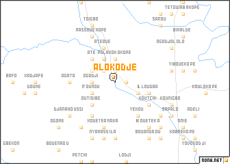
Alokodjé (Togo)Alokodjé is a town in Togo. An overview map of the region around Alokodjé is displayed below.
regional and 3d topo map of Alokodjé, Togo ::
Alokodjé airports ::
The nearest airport is LFW - Lome Gnassingbe Eyadema Intl, located 183.4 km south of Alokodjé.
Other airports nearby include COO - Cotonou Cadjehoun (214.9 km south east), LRL - Niatougou Niamtougou International (215.7 km north), TML - Tamale (289.4 km north west), Nearby towns ::
Palakoko (1.9km north) //
Akabasim (1.8km east) //
Akapokopé (2.6km north west) //
Palakokokopé (3.7km north) //
Ogodji (3.7km west) //
Ouorouo (4.1km north west) //
Bétia (4.1km north west) //
Atakédibato (4.1km south east) //
Itounou (4.1km south west) //
Até (5.2km north west) //
Outisibé (5.2km south west) //
Illougba (5.8km east) //
Atéoué (5.9km north) //
Yékou (6.7km south east) //
Agoudévé (6.7km south west) //
Koutchi (6.6km south east) //
Ogato (7.3km west) //
Kouété Amava (7.6km south) //
Massouékopé (8.3km north west) //
Aniélakou (9.2km south east) //
Ikouétéka (9.2km south east) //
Gouné (9.2km south west) //
Djanahoussi (9.2km south west) //
Djidopo (10.4km south east) //
[all distances 'as the bird flies' and approximate] 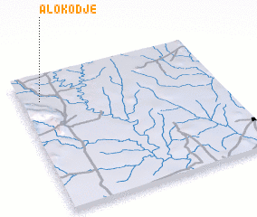 Places with similar names to Alokodjé, Togo ::
// Ali Kodji (TG)
Disclaimer :: Information on this page comes without warranty of any kind |
||
|
Where is Alokodjé? Elevation and coordinates ::
Latitude (lat): 7°49'0"N Longitude (lon): 1°6'0"E
Elevation (approx.): 179m (map arrows pan, magnifying glasses zoom) |
||
|
Visiting Alokodjé? Hotel/Accommodation ::
Book a hotel in Alokodjé Travel Guide ::
Buy a travel guide for Togo rental cars ::
car rental offers GPS waypoint ::
download a GPX waypoint (PoI) of Alokodjé for your GPS receiver
|
||