|
search place name
|
||
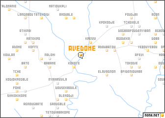
Avédomé (Togo)Avédomé is a town in Togo. An overview map of the region around Avédomé is displayed below.
regional and 3d topo map of Avédomé, Togo ::
Avédomé airports ::
The nearest airport is LRL - Niatougou Niamtougou International, located 192.6 km north of Avédomé.
Other airports nearby include LFW - Lome Gnassingbe Eyadema Intl (206.6 km south), COO - Cotonou Cadjehoun (223.7 km south east), Nearby towns ::
Ayékpada (1.9km north) //
Kokoté (2.6km south west) //
Kalékodi (4.1km north east) //
Kpéssi (4.1km north east) //
Adoubatou (5.8km east) //
Atioukoufe (5.8km east) //
Elavagnon (6.6km south east) //
Nalomi (7.3km west) //
Babame (7.6km west) //
Dagou (7.6km east) //
Nyamassila (7.8km south west) //
Dousekboulé (8.3km south west) //
Kpokodjé (9.2km north east) //
[all distances 'as the bird flies' and approximate] 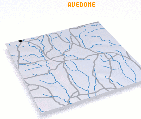 Places with similar names to Avédomé, Togo ::
// Avetome (GH)
// Avodim (NG)
// Ấp Hòa Tâm B (VN)
// Ấp Hội Tâm (VN)
// Afidemgha (TG)
// Avédomé (TG)
// Āfdem (ET)
// Áfià Demba (GW)
Disclaimer :: Information on this page comes without warranty of any kind |
||
|
Where is Avédomé? Elevation and coordinates ::
Latitude (lat): 8°2'0"N Longitude (lon): 1°15'0"E
Elevation (approx.): 201m (map arrows pan, magnifying glasses zoom) |
||
|
Visiting Avédomé? Hotel/Accommodation ::
Book a hotel in Avédomé Travel Guide ::
Buy a travel guide for Togo rental cars ::
car rental offers GPS waypoint ::
download a GPX waypoint (PoI) of Avédomé for your GPS receiver
|
||