|
search place name
|
||
Békouleb (Togo)Békouleb is a town in Togo. An overview map of the region around Békouleb is displayed below.
regional and 3d topo map of Békouleb, Togo ::

Békouleb airports ::
The nearest airport is LRL - Niatougou Niamtougou International, located 67.4 km north east of Békouleb.
Other airports nearby include TML - Tamale (182.2 km west), Nearby towns ::
Binanoualiba (0.0km north) //
Bassar (1.8km east) //
Boukpassiba (1.8km west) //
Wadandé (1.9km north) //
Bikoutikpandi (1.8km west) //
Binaparba (1.9km south) //
Kétangbao (2.6km north east) //
Jimbiri (2.6km south east) //
Moandé (3.7km south) //
Séni (3.7km south) //
Kankoundé (4.1km south east) //
Nangbani (4.1km north east) //
Langondé (4.1km south west) //
Dianta (5.5km east) //
Kalanga (7.5km west) //
Naouléma (7.5km west) //
[all distances 'as the bird flies' and approximate] 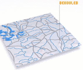 Places with similar names to Békouleb, Togo ::
Disclaimer :: Information on this page comes without warranty of any kind |
||
|
Where is Békouleb? Elevation and coordinates ::
Latitude (lat): 9°15'0"N Longitude (lon): 0°46'0"W
Elevation (approx.): 325m (map arrows pan, magnifying glasses zoom) |
||
|
Visiting Békouleb? Hotel/Accommodation ::
Book a hotel in Békouleb Travel Guide ::
Buy a travel guide for Togo rental cars ::
car rental offers GPS waypoint ::
download a GPX waypoint (PoI) of Békouleb for your GPS receiver
|
||