|
search place name
|
||
Bétékpo (Togo)Bétékpo is a town in Togo. An overview map of the region around Bétékpo is displayed below.
regional and 3d topo map of Bétékpo, Togo ::

Bétékpo airports ::
The nearest airport is LFW - Lome Gnassingbe Eyadema Intl, located 102.0 km south of Bétékpo.
Other airports nearby include COO - Cotonou Cadjehoun (129.7 km south east), LOS - Lagos Murtala Muhammed (213.8 km east), ACC - Accra Kotoka Intl (241.1 km south west), Nearby towns ::
Akpaka Sagada (1.8km east) //
Dadiérémé (2.6km north west) //
Akaképo (5.8km west) //
Atchavou (5.9km south) //
Adjakpohoué (5.9km south) //
Sagada (5.8km east) //
Kpététa (6.7km north west) //
Avédji Sagada (6.6km south east) //
Kplélé (6.6km south east) //
Khouitokopé (7.6km south) //
Kamé (7.8km south west) //
Adjigémé (7.8km south west) //
Avou (7.8km south east) //
Tététou (7.8km south east) //
Aladjové (8.3km south west) //
Ahion (8.3km south east) //
Asrama (8.3km south west) //
Dogokono (9.2km south west) //
Zokouvé Kpoguédé (9.2km south east) //
[all distances 'as the bird flies' and approximate] 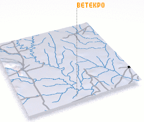 Places with similar names to Bétékpo, Togo ::
// Bodoukpo I (CF)
// Bodoukpo II (CF)
// Botikpo (CD)
// Batokope (GH)
// Betekpo (GH)
// Betekpo (GH)
// Batoicopo (GQ)
// Batékpo (TG)
// Bédékopé (TG)
// Bodoukpé (TG)
Disclaimer :: Information on this page comes without warranty of any kind |
||
|
Where is Bétékpo? Elevation and coordinates ::
Latitude (lat): 7°4'0"N Longitude (lon): 1°27'0"E
Elevation (approx.): 116m (map arrows pan, magnifying glasses zoom) |
||
|
Visiting Bétékpo? Hotel/Accommodation ::
Book a hotel in Bétékpo Travel Guide ::
Buy a travel guide for Togo rental cars ::
car rental offers GPS waypoint ::
download a GPX waypoint (PoI) of Bétékpo for your GPS receiver
|
||