|
search place name
|
||
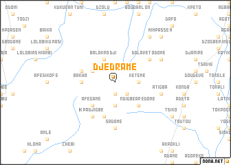
Djédramé (Togo)Djédramé is a town in Togo. An overview map of the region around Djédramé is displayed below.
regional and 3d topo map of Djédramé, Togo ::
Djédramé airports ::
The nearest airport is LFW - Lome Gnassingbe Eyadema Intl, located 130.3 km south east of Djédramé.
Other airports nearby include ACC - Accra Kotoka Intl (194.0 km south west), COO - Cotonou Cadjehoun (213.3 km south east), Nearby towns ::
Koudjragan (1.9km south) //
Kakpa (2.6km south east) //
Kétémé (3.7km east) //
Koudjravi (3.7km south) //
Balakpodji (4.1km north west) //
Bala (4.1km north west) //
Mate (4.1km north west) //
Afegame (5.2km south west) //
Ndigbé Apédomé (5.2km south east) //
Bakwa (5.5km west) //
Avedjeme (5.8km west) //
Ikpa Anigbé (5.9km south) //
Dalavé Todomé (6.6km north east) //
Ikpa Djigbé (6.7km south west) //
Sadomé (7.4km south) //
Atigba (7.6km east) //
Apéyémé (8.2km north east) //
Dzogbégan (9.2km north east) //
Mimpassem (10.4km north east) //
[all distances 'as the bird flies' and approximate]  Places with similar names to Djédramé, Togo ::
// Djitriamé (TG)
Disclaimer :: Information on this page comes without warranty of any kind |
||
|
Where is Djédramé? Elevation and coordinates ::
Latitude (lat): 7°10'0"N Longitude (lon): 0°38'0"W
Elevation (approx.): 748m (map arrows pan, magnifying glasses zoom) |
||
|
Visiting Djédramé? Hotel/Accommodation ::
Book a hotel in Djédramé Travel Guide ::
Buy a travel guide for Togo rental cars ::
car rental offers GPS waypoint ::
download a GPX waypoint (PoI) of Djédramé for your GPS receiver
|
||